Ingleton Waterfalls & Twistleton Scar

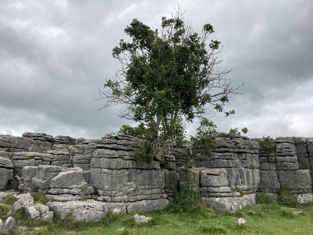
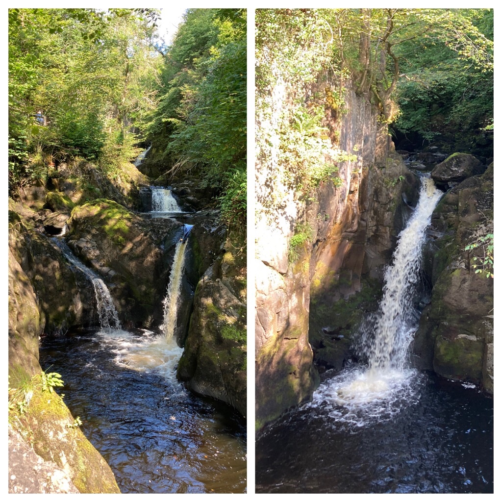
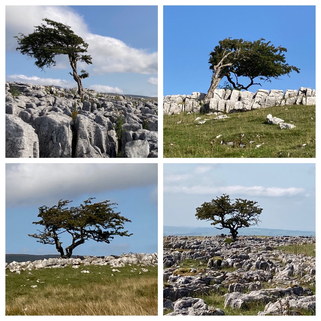
I’d seen some pictures of solitary trees growing out of the limestone pavement at Twistleton Scar and when we looked at the map, realised we could combine this with the Ingleton Waterfall Trail. The trail was opened in 1885 after paths and bridges were built to improve access to the waterfalls. Today it is well organised with a big car park and an entry fee which seemed reasonable for a 4.5 mile trail and a number of waterfalls along the way. We walked uphill along the River Twiss passing Pecca Falls, Pecca Twin Falls and Holly Bush Spout.

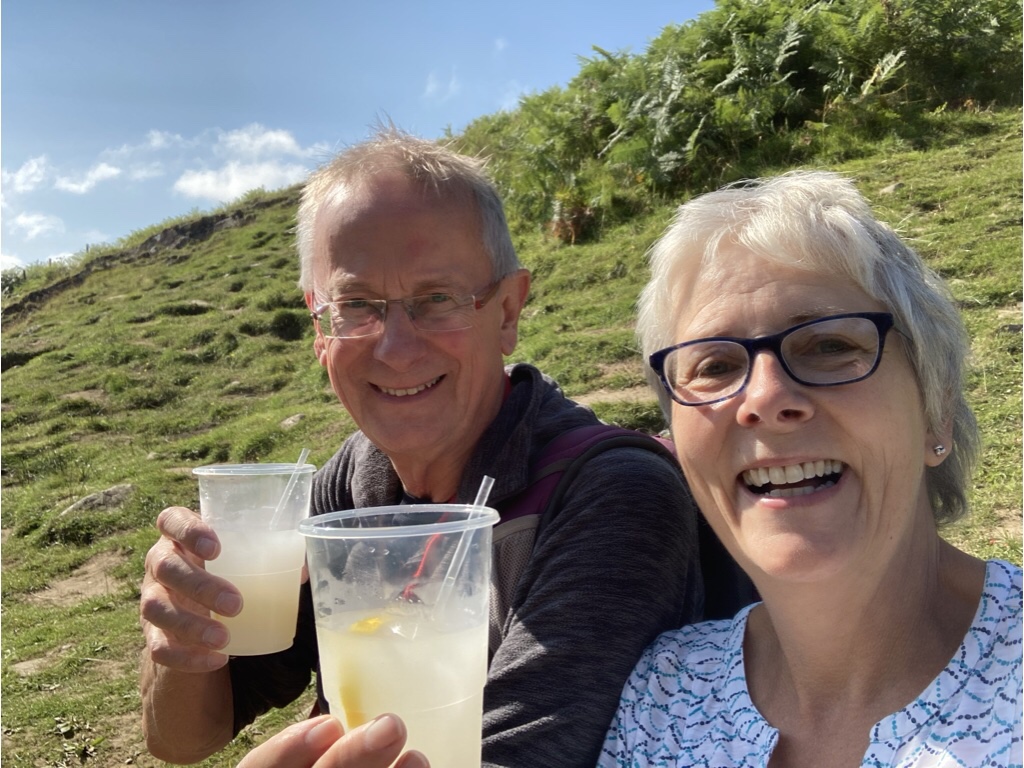
As we climbed out of the valley, there was a stall selling refreshments and the fresh lemonade with spring water was most welcome.

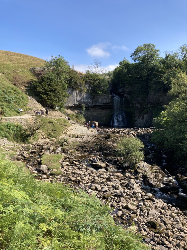
Round the corner was the singularly most impressive waterfall, Thornton Force.

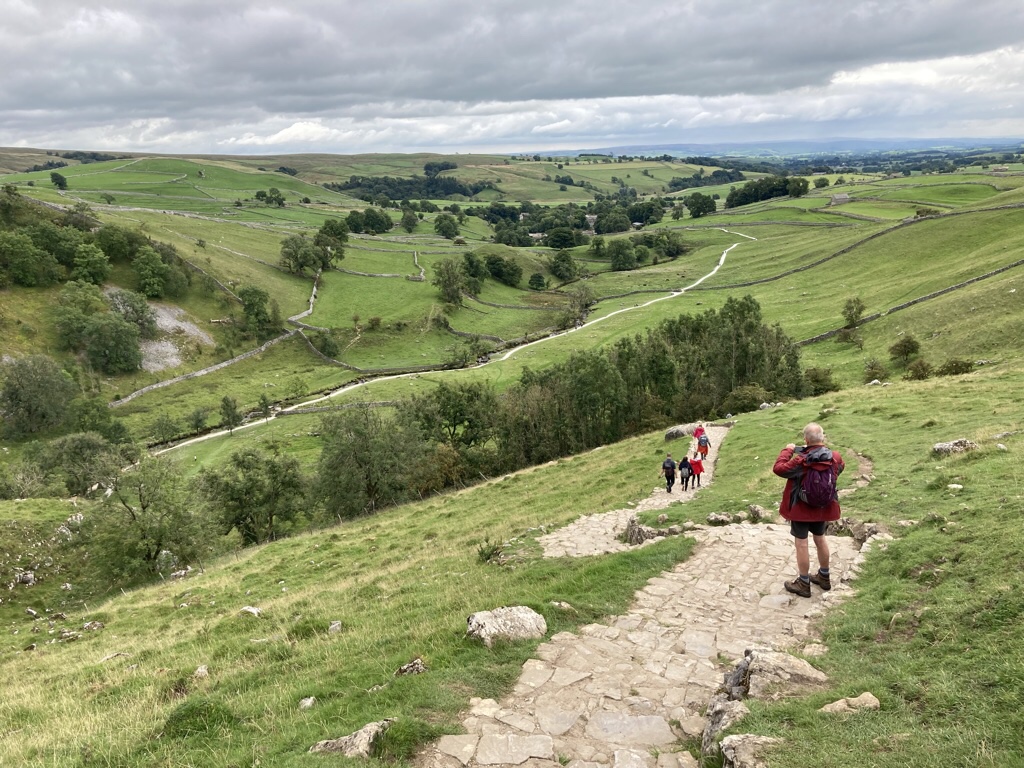
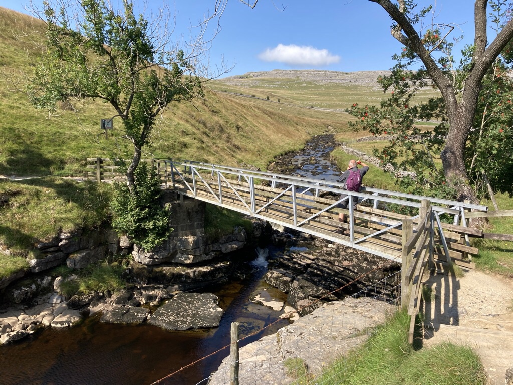
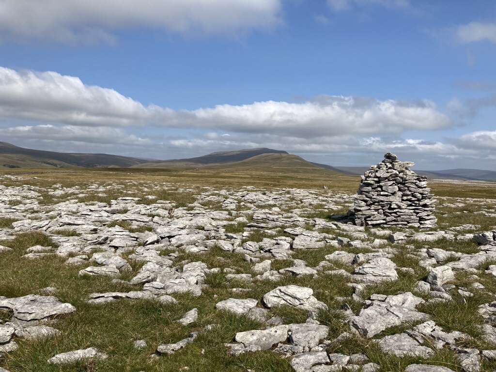
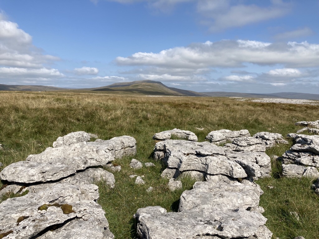
The path then heads our of the valley and along Twistleton Lane, but we took a detour, along a bridle way which climbed up to the top of Twistleton Scar.

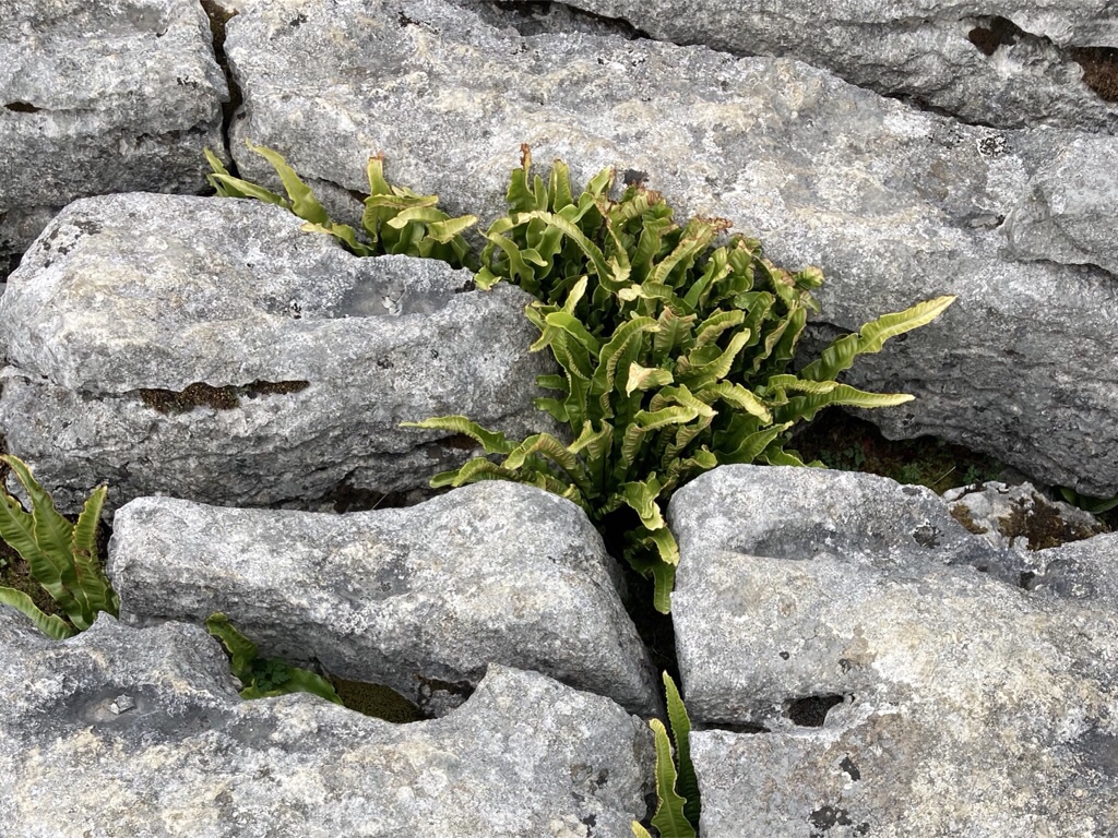
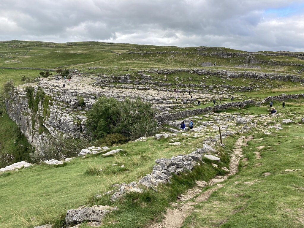
At the top we found the limestone pavement, sheep and a few trees.

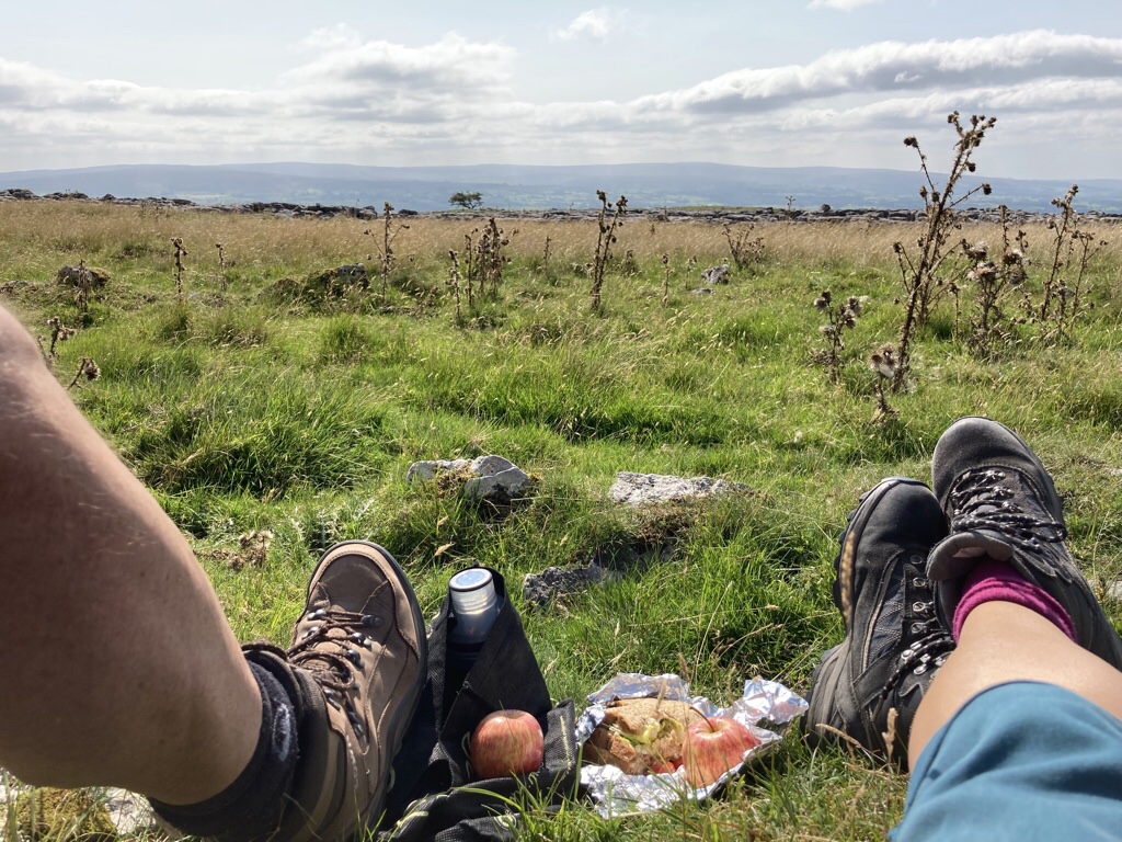
We found a sheltered spot for to eat our sandwiches …

then made our descent. The trail continues along the banks of the River Doe passing Beezley Falls and Baxenghyll Gorge, but there are only so many waterfalls you can photograph! We returned through the village to the car park and were exhausted! At 7.4 miles, it wasn’t the most we’d clocked up, but with all the steps up and down and the climb up Twistleton Scar it felt the most demanding.

Back for a cuppa and to read more of my Dales mystery. I love it when I find a book set where I’m staying and several of the places mentioned are local like Goat Lane, Twistleton & Ribble so I wasn’t surprised when I googled Julia Chapman and found that while Bruncliffe is fictional, it’s location is exactly where Settle is, just two miles down the road! And that’s where we headed for dinner, to The Talbot for a very good meal on our last night, before driving home tomorrow.

Had a great drive home, stopping at Little Moreton Hall in Congleton on the way, just a short hop from the motorway. Well worth a visit with really inspiring volunteers.

Postscript

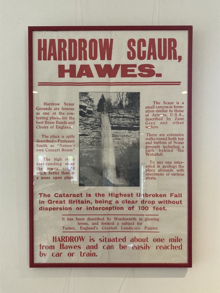
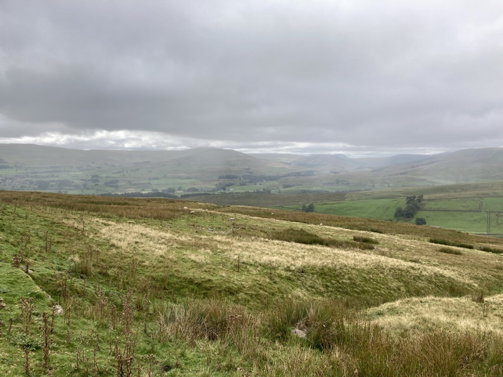
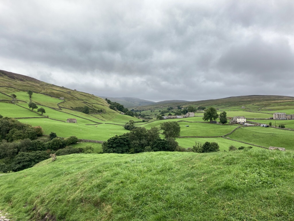
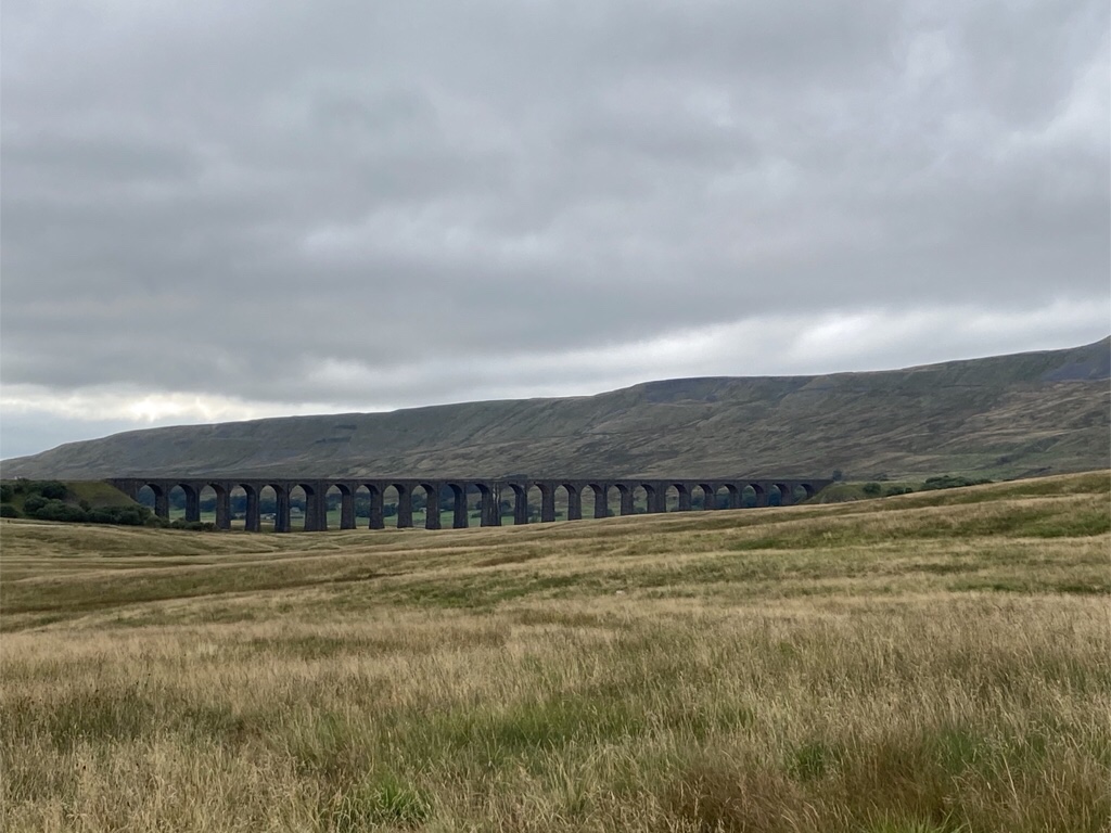
Hadrian’s Wall was a great idea for a destination and the reality certainly ticked all the boxes. We drove 1181 miles, walked 75 miles and visited three National Parks … not record breaking but great fun especially as we only had one wet day. We walked round the highest lake in England, visited the highest single drop waterfall in the country and while we might not have climbed the Yorkshire Three Peaks, we did photograph them! None of the photos do justice to the size of the landscape with huge open spaces, big skies and sheep everywhere and we will definitely be going north again.

Chris’s Photos

Chris rarely gets a photo included here as it takes time to convert raw files and he processes them in Lightroom once we get home, so click on the photo below to go to his Flickr album and he’ll add his photos over the next week or two … worth a look and a diary note!

Keld waterfall ramble....another one!😊

Keld waterfall ramble....another one!😊

Malham Tarn

I woke early and finally finished my book, leaving several loose ends which no doubt continue to the next book in the series! I’ve now gone from a body in Scyamore Gap to one in Gordale Scar where we walked yesterday in a Dales mystery called Date with Death! Sounds like this walking lark might be a bit more dangerous than just a blister!

We began our day with another of the best drives in the dales, along Goat Lane which climbs out of Stainforth then heads uphill with the 694m peak of Pen-y-Ghent appearing on the left, the lowest of Yorkshire’s Three Peaks.

The lane becomes the Pennine Way and dips down into the valley of Littondale, with the scattered cottages of Halton Gill at the foot of the fell. Despite meeting several cars, a cyclist and two walkers hiking the Pennine Way, it still feels a long way from civilisation and when you look at a map, you realise you are!

We looped round to Malham Moor and parked beside Malham Tarn, 377m above sea level and the highest lake in England, then walked round it. The whole area is owned by the National Trust, including Tarn House on the far side of the tarn, once owned by Walter Morrison who had such visitors as Charles Darwin and John Ruskin as well as Charles Kingsley who was inspired by the local scenery and Darwin’s ideas of evolution when he wrote the Water Babies.

We stopped to eat sandwiches, then continued walking round, spotting a rabbit and deer on the way!

The last stretch took us across fields to an old smelt chimney which gave a great view all round. During the 18th century, lead, copper and zinc carbonate were mined on Pike Daw, the crushed metal ore was processed at the smelt mill and a long flue led from the mill to this chimney, where the toxic fumes dispersed.

Another great walk and the sun even came out towards the end. Back to our cottage and a curry feast curtesy of the Co-op … perfect!

Map

Malham Cove

After a quick forage in Settle for a few groceries, we went walking, having passed these fine chaps on the way …

Malham Cove is apparently the most popular walk in the Yorkshire Dales and why not, when according to one story it is a giant hoof print made when the Norse god Odin was riding his horse Sleipnir! It has been attracting visitors for centuries, with painters such as JMW Turner promoting the area further. It’s a popular spot, but there was ample car parking and plenty of space for everyone. We took the footpath through the village and across the fields to Malham Cove, a huge limestone amphitheatre shaped cliff and sat on a rock and ate our sandwiches pondering the fact that this would once have been a huge waterfall. Today there is a small underground stream that emerges at its foot and becomes the Malham Beck. Above were climbers attempting ascent of the rock face.

We took the path to the left which became quite a long flight of rough steps to the top of the cliff. We could look down and see the path snaking back to the village.

The top of the cove is a large area of deeply eroded limestone pavement, where slightly acid rainwater has gradually dissolved the rock along faults and cracks.

Clints are the blocks of limestone that constitute the paving and grykes are the fissures that separate them where a varIety of plants thrive as the sheep can’t get them!

It was best to take care the gaps were quite big enough to trap a foot. If it looks familiar, it was the spot that Harry and Hermione camped out in Harry Potter and The Deathly Hallows.

From here we followed others, across the top …

… then down to Gordale, then left, alongside the stream, into another amphitheatre of cliffs either side towards a waterfall at the head of the scar.

Looking outwards, the narrowing of the scar is almost more obvious.

The final leg of the walk was back to Malham village via Janet’s Foss, a waterfall where the drop pool was traditionally used for sheep dipping. The name Janet or sometimes Jennet is thought to be a folk tale reference to a fairy queen who inhabited a cave at the rear of the waterfall.

As we walked back to the car, we’d clocked up 6.8 miles and the completion of the most popular walk in the Yorkshire Dales. We had a quick look in the shop and I was making a note of a novel set in the Dales for future reading when I overheard a walker who had misunderstood the bus timetable. He had a problem getting back to Settle for his train, and without thinking too much about it, we offered him a lift and were happy to help.

That evening we cooked … or leastways heated pasta sauce we’d bought at Tebay services to have with pasta and broccoli … once we’d mastered the hob!

Map

Keld Waterfalls

Apart from a brief pause at the Dandry Mire Viaduct at Garsdale …

… our first stop was Hardraw Falls, famed for being the highest single drop waterfall in England at 100ft. As we saw from the poster in the tea room, it’s been an attraction since Victorian times, but today was somewhat quieter with a choice of path either to the base or the top of the falls. We chose the easy path with the best view of the falls …

… then walked back for coffee and a scone with cream and jam to keep us going.

Buttertubs Pass is a 6 mile stretch of road between Simonstone in Wensleydale and Thwaite in Swaledale and has been described as a spectacular road. We enjoyed it … both ways as it happens … one way more slowly with a couple of stops and then back, faster in search of a late lunch!

There are lots of these small banty barns or cow houses which protest the animals in winter. They are stabled below and the hay is stored above, cut from the surrounding fields. In the spring they are let out to graze and the muck used to fertilise the fields.

In between, we went walking in Keld, in search of waterfalls, but while ten fine days has made our trip north a real pleasure, it hasn’t boded well for the flow of water in the falls. We walked along the River Swale …

.. but the walk instructions were a bit vague, so we only found East Gill force …

… and Wain Wath Falls where people were actually swimming … albeit in wet suits … while Kidson Falls eluded us.

Some of the countryside was lovely and here’s one of those banty barns up close.

Having worked up an appetite, we just made the Wensleydale Creamery in time to experience their Yorkshire Wensleydale & Yorkshire Red Cheese on Toast served with Tomato & Chilli Chutney and Dressed Leaves and a cup of Yorkshire tea … as Wallace would say … cracking!

A couple more pics along the way – Whernside, the highest of Yorkshire’s Three Peaks at 736m, rises behind the Ribble Viaduct, the longest of 22 viaducts along the 73 mile Settle to Carlisle railway …

… and Ingleborough the second highest peak and the most recognised, looking like a chunk’s been chipped off!

We found our rental, a cute stone cottage in Long Preston …

… and had a quiet evening, not even needing dinner after such a late lunch, just a snack.

Map