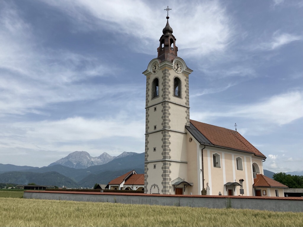
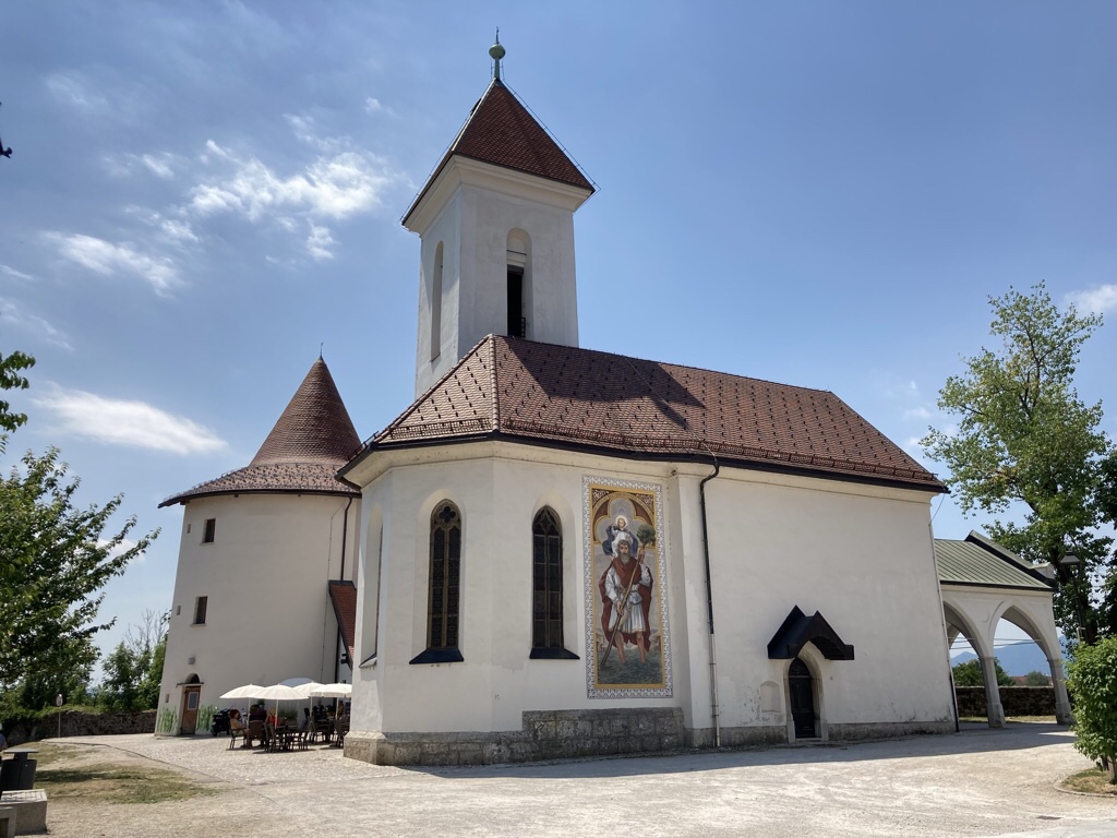
Having picked up the car, we were lured into the first small village we passed to photograph the church with the mountains behind. All the houses were tidy and beautifully kept with window boxes spilling with flowers and neat piles of wood drying for the winter.
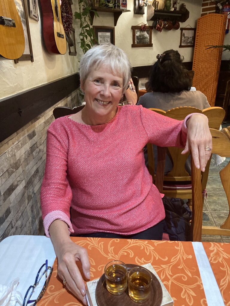
Love the small cups of coffee served with a glass of water.
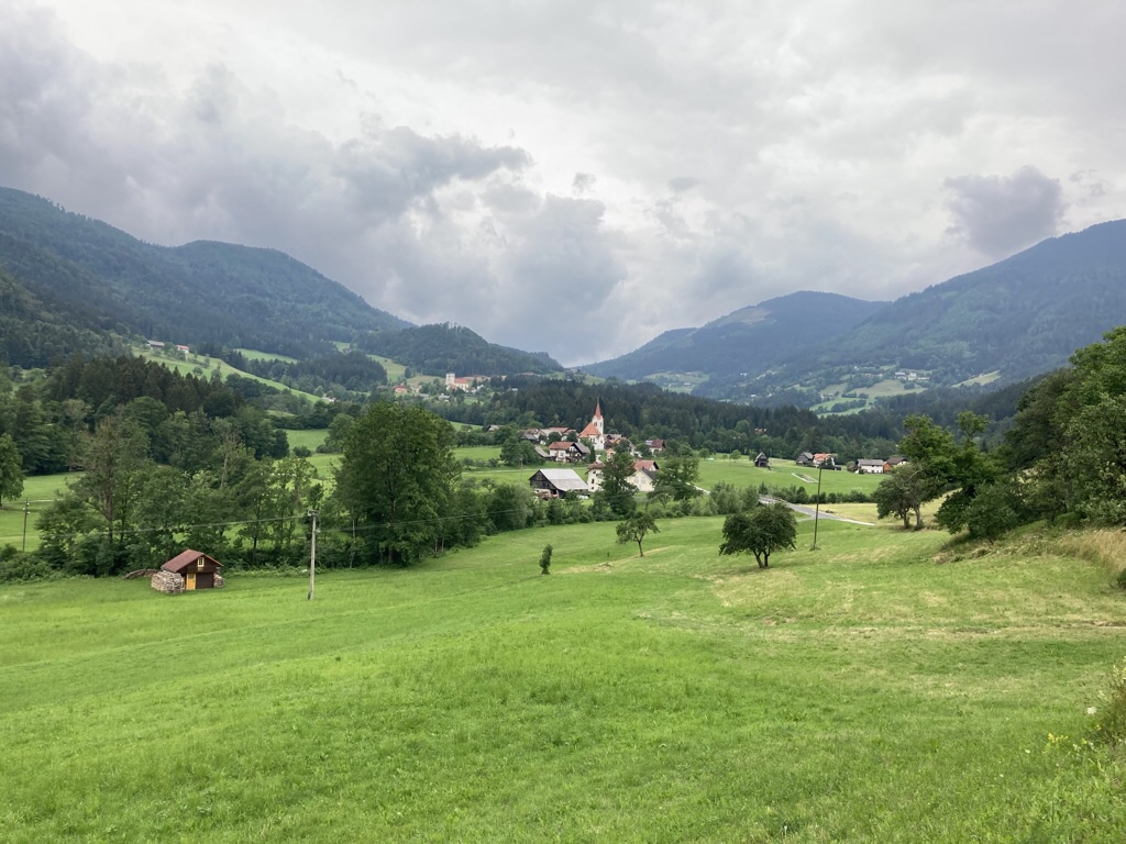
Our drive was leisurely as we soaked up the views on the way, but stopping places were scarce and there will be plenty of photo ops later.
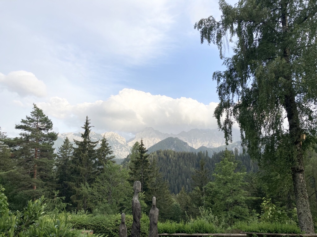
The road followed the valley, then climbed with hairpin bends before levelling out again to run along a high valley, through the village of Solčava and on to our pension, Planinski Dom Majerhold. Very fitting for the name to mean Mountain Home Majerhold as we found a huddle of wooden chalets set into the hillside at 1150m, surrounded by flowers and with mountains all around. When I realised this glacial valley is almost as high as the highest peak in the British Isles it certainly but it into better perspective for me.
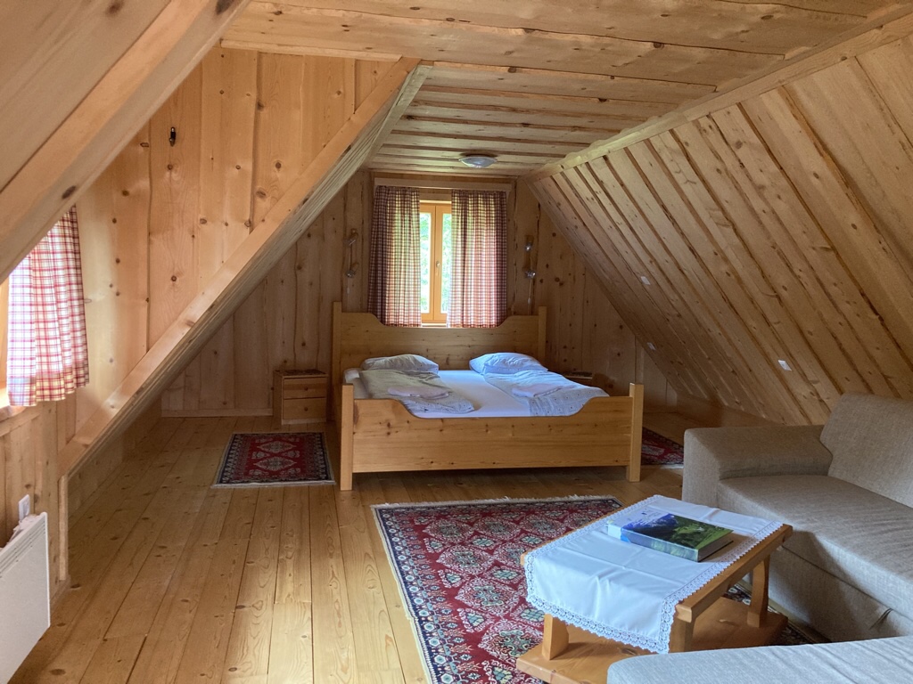
Here is our chalet where we have the upstairs room which is very comfortable.
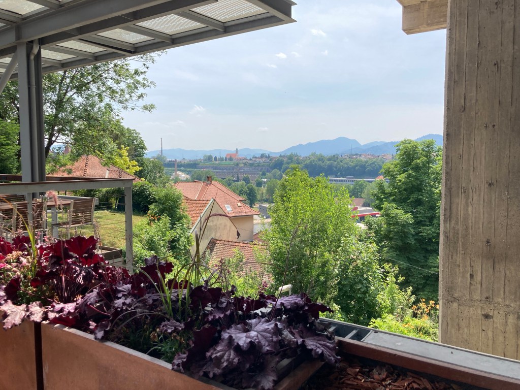
Our balcony is perfect for relaxing and takes in a view of the Kamnik-Savinja Alps. It is dominated by Ojsterica, the tallest peak at 2350m, with Križevnik on the left and a collection of smaller peaks on the right, all of which stand as guardians over the Logar Valley concealed between.
We spent the afternoon enjoying our surroundings, and I even joined a small group on the grass doing yoga. All we could hear was birdsong and the background buzz of others sitting out and chatting as we shared a beer and made a bit of a plan for tomorrow.
Dinner was simple but delicious, a local barley soup, pork and cheesy courgette from the grill with roast potatoes and salad then apple strudel to finish, which we ate sitting outside overlooking the mountains.
Two weeks ago, we weren’t even sure we’d make it as EasyJet cancelled our outward flight, but we managed to rebook for a day earlier. An extra day on our car hire would have been £200, so here we are in Kranj for the first night, just 15min by public bus from the airport and we’ll pick up the car tomorrow.
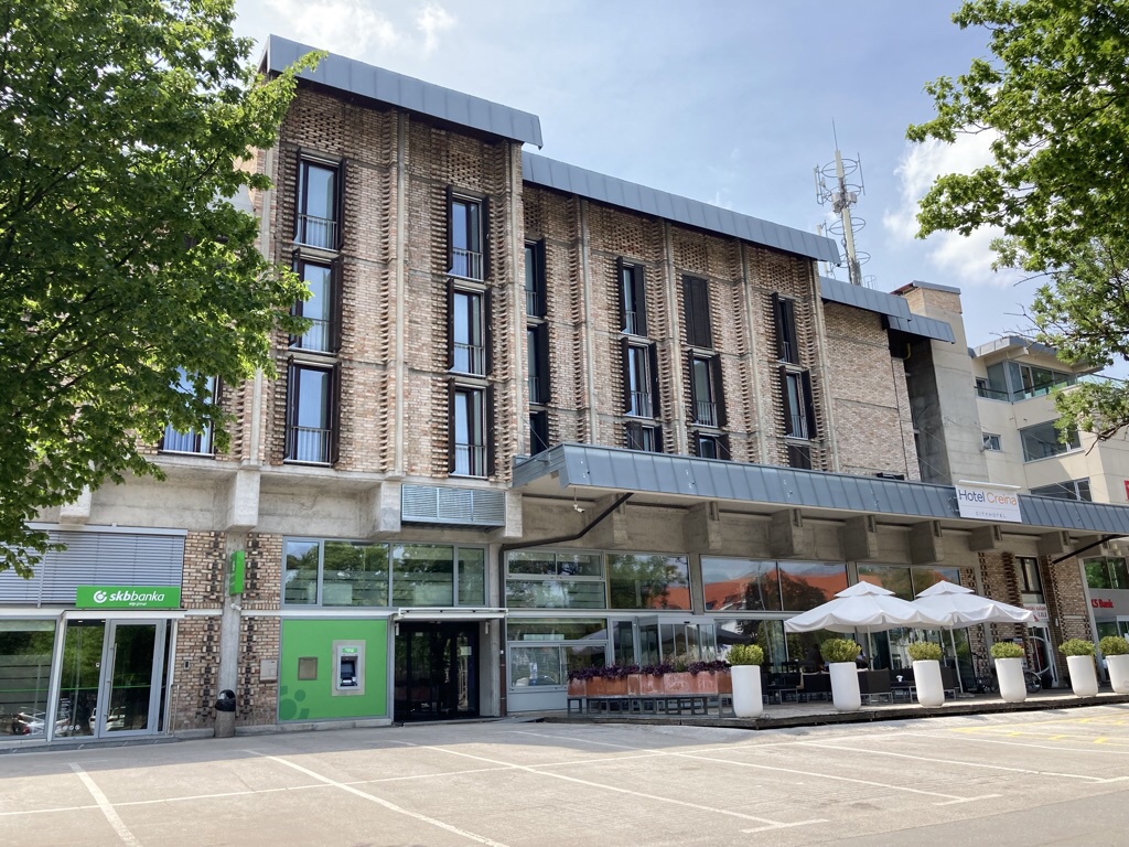
We arrived mid morning at Hotel Creina, surprisingly a historical and cultural monument as designed by Edvard Ravnikar, a renowned Slovenian architect in the 1970’s.
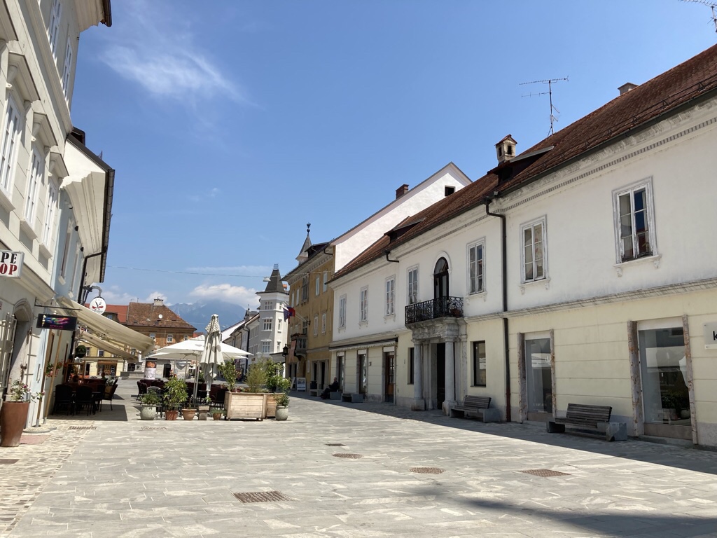
We left our luggage in the hotel and went to explore. Kranj is the fourth largest town in Slovenia, forming quite a sprawling urban area, but the medieval centre quite small, set on a rocky promontory between a couple of rivers below. The main street is fronted by some handsome buildings but it was very quiet, and many of the shops look empty.
The church was covered in scaffolding and we so we didn’t see the treasures within.
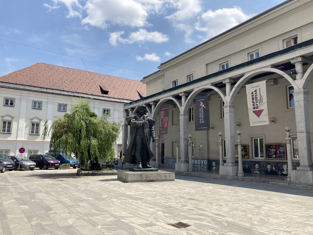
The square contains a statue of France Prešeren the C19th Romantic Slovene poet and hero who did much to awaken the Slovene national awareness.
There is also this arcade and stairway, squeezed in between existing buildings, designed by Jože Plečnik, a Slovene architect who trained in Vienna under Otto Wagner and proceeded to have a major impact on the modern architecture of Vienna and Prague before returning to Ljubljana in 1920 to do the same there.
At the far end is a small church and then just a drop down the the gorge below.
That was enough exploring so we found a cafe for lunch where I had a salad topped with grilled hake in a tomato sauce and Chris had fried cheese and roast potatoes.
Later we made our way back to the hotel, realising that being up before the birds this morning, the very warm day and a delicious lunch had taken their toll but were surprised to nap for two hours!
Having woken, it was cooler and when we opened the window, we saw what looked like a choir forming in the square outside so went to see. They just began when we got there and sang a selection of folk songs. Chris got talking to chap who said it was Cultural Day and every town in Slovenia had choirs like this who would be singing today. It was a lovely welcome to Slovenia and we spoke to a couple of the choir afterwards and we even got a mention on their Facebook page!
The square also had several striking black statues with a revolutionary scheme. They were made by Lojze Dolinar in 1961 and show Strike of the Carniolian textile workers, National Liberation Struggle simulating an attack on the enemy bunker and Revolutionary Flight.
We went to a another cafe in the old town for dinner and the roast pork was very good. Chris had a bean salad and fries, but we did know that veggie choices here would be limited. The very quaffable local beer and red wine made up for any shortcomings as we watched the world go by with lots of walkers and cyclists enjoying the cooler air.
We were able to look out over the gorge for breakfast, the second largest in Europe, a fact difficult to appreciate from any viewpoint we found, as we munched our way through the breakfast buffet.
Kranj was an added bonus we’d not planned for and now we are off to collect our car!
It was a picture like this that gave us the idea of taking a trip to Slovenia … stunning mountain scenery, lush green valleys and easy walking. Three years later, we’ve got a cancelled trip behind us and a dodgy knee awaiting replacement so there won’t be much walking, but we’re going anyway!
We’re heading to the north west of the country, to the Logar Valley where we can follow the Solčava panoramic road as it winds through the alpine landscape, then on to Lake Bled, the unmissable jewel of Slovenia with its emerald lake surrounded by mountains and finally to nearby Lake Bohinj which is a little quieter but just as beautiful.
The forecast says top twenties with the odd shower so we’ve adjusted the packing list and are ready to go. Fingers crossed there are no airport delays then you can join us for lunch in Kranj tomorrow!
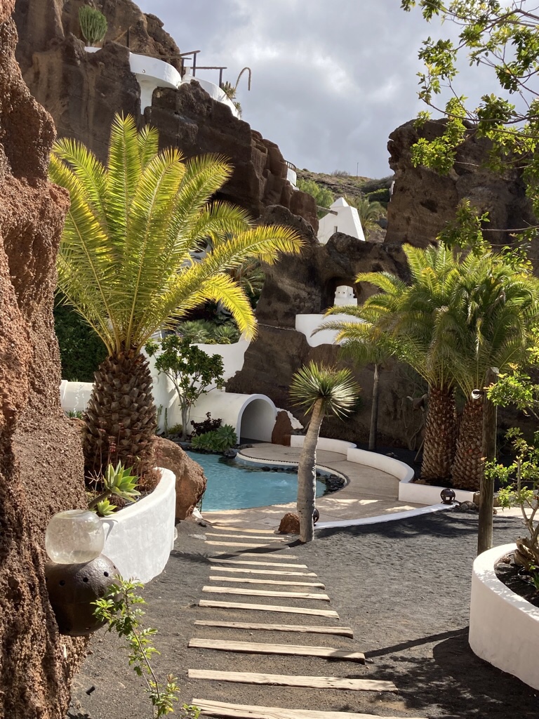
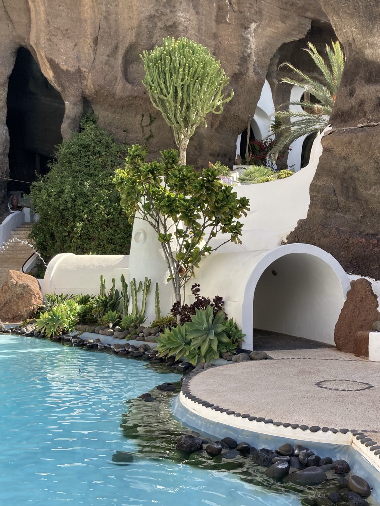
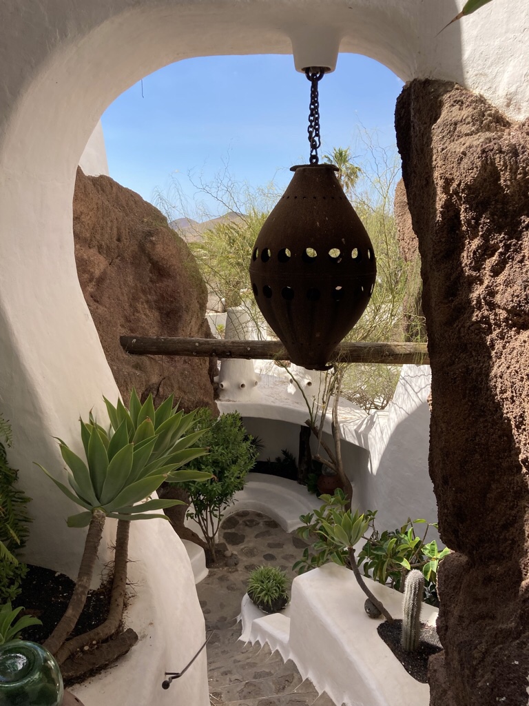
The next day we returned northwards, this time to see Famara at sea level, but made some stops along the way. Firstly LagOmar, a house originally conceived by Manrique, then designed by Jesús Soto for the British developer Sam Benady with an architectural vision that evoked images of the arabian nights stories.
The story goes that when Omar Sharif came to film The Mysterious Island, he fell in love with the house and bought it on the spot, but Sharif was soon to lost the property to champion bridge player and former owner San Benady in a game of cards.
In 1989 architects Dominik von Boettinger from Germany and Beatriz van Hoff from Uruguay bought the house and developed it further into an arts space with bar and restaurant and it was first opened to the public in 1997. We walked round the labyrinth of caves cut into a volcanic quarry which contrasted starkly to the smooth white curves of the architecture.
Next up was the old capital where we stopped for a lunch of tortilla and salad at El Chiringuito, and I enjoyed a clara in the sun, and will tell you how it got its name.
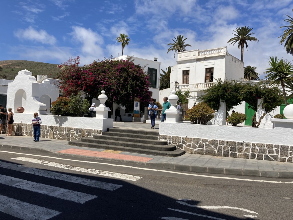
Lanzarote is named for Lancelotto Manocello, a Genoese Navigator who arrived in 1312 and rediscovered the Canary Islands for the Europeans. There were various marauding expeditions over the next century, either to enslave the local Guanche natives or to plunder other resources so when the Norman privateer, Jean de Bethencourt began the conquest of the islands for the Spanish in 1402, he found the depleted population on Lanzarote happy to sign a pact in return for protection from pirates. His nephew Maciot de Bethencourt, married the Guanche Princess, Teguise, and to found the town of the same name, which became the capital until the C19th. We stopped in Teguise centered on the plaza and the pretty Inglesia de San Miguel.
Important buildings can be spotted by their use of wood for railings and balconies, a status symbol on an island without trees and it was a pleasure to take a wander round the streets.
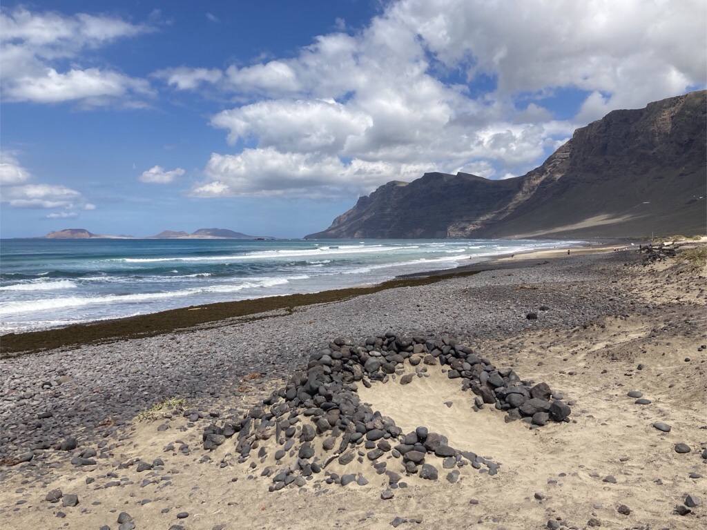
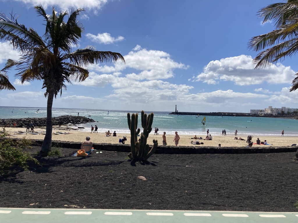
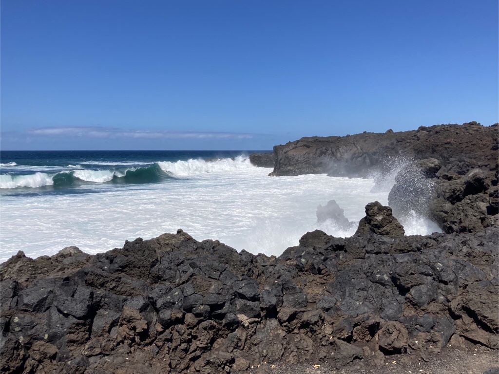
Time for a walk, so we stretched our legs along the beach at Famara which sits at the base of those huge 600m cliffs. The beach is windy and the waves make it popular with surfers. Those curved dry stone walls seen at the vineyards have been pressed into service here too making natural wind breaks for eager sun worshippers.
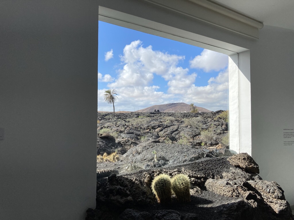
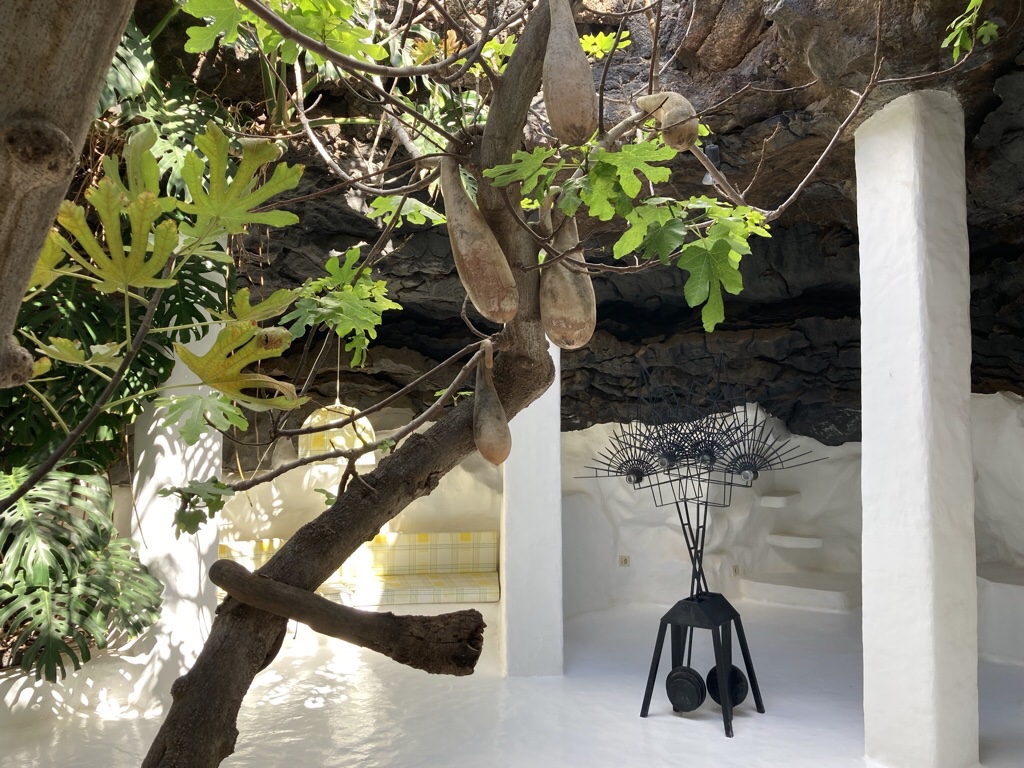
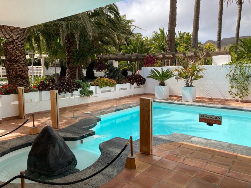
Our final stop on the way back was Volcano House, the house Manrique built in 1968, built on the surface of a dome of lava from the 1730-1736 eruptions. The upper floor is large and airy, modern with traditional features …
… but the lower level is built around five natural volcanic bubbles interconnected by tunnels excavated in the lava. The stylish design and flashes of orange definitely look pure 1970’s and with retro enjoying a comeback, it looks just as on trend today!
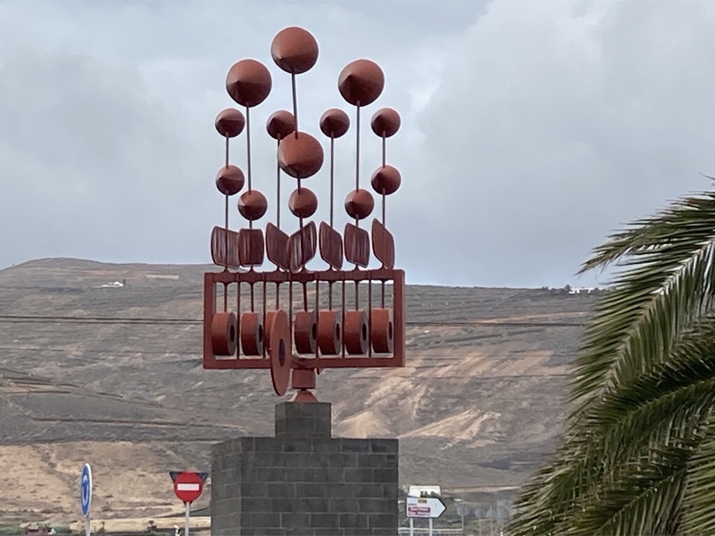
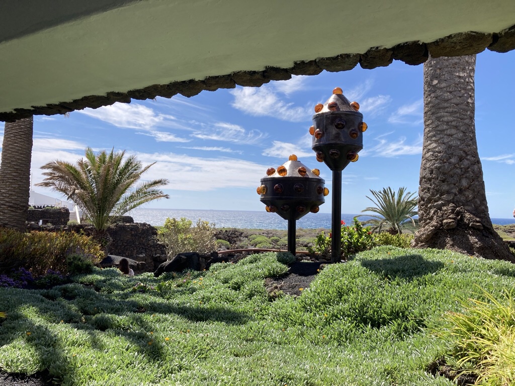
Manrique had a thing about wind toys which evolved from his attempt to create something to replace the island’s disappearing windmills. These two were outside Volcano House …
… and he placed this one on a roundabout in Arrieta in 1992.
This one called Fobos was erected by CACT in Tahiche, on the same roundabout where he met his death in a car accident.
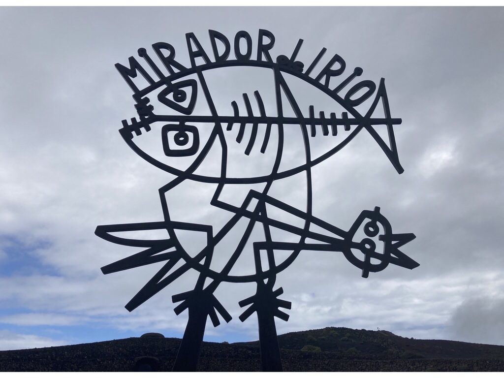
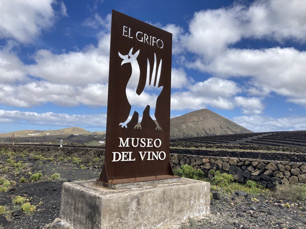
Manrique also designed a number of signs on the island, some of which we’ve already seen like El Diablo in Timanfaya and the logos for El Grifo Bodega, Canarian Salinas and Mirador Rio … and the last couple are coming up!
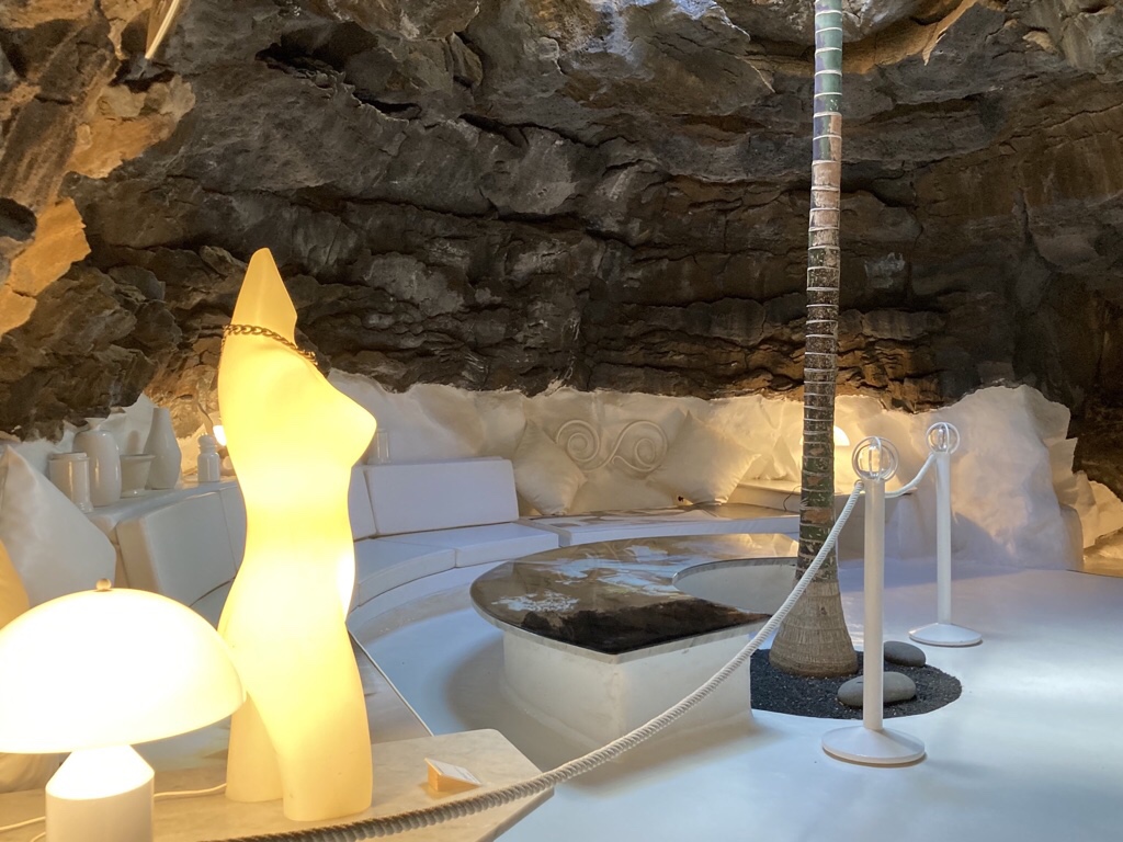
We headed coastwards to the first tourist attraction opened on Lanzarote, The Cuevas de Los Verdes which are part of a 6km long lava tube which formed about 4,000 years ago when the Montaña La Corona erupted. They are caused by the surface lava cooling and hardening while the lava inside continues to flow leaving a tube behind. The caves have been used for centuries for locals to hide from invaders but in 1964 a 2km pathway was opened up. With no natural light, it has been lit to show off the caves to their best effect, thanks to the skill of Jesus Soto. There is even a secret attraction, but we were sworn to secrecy so you will need to visit for yourself!
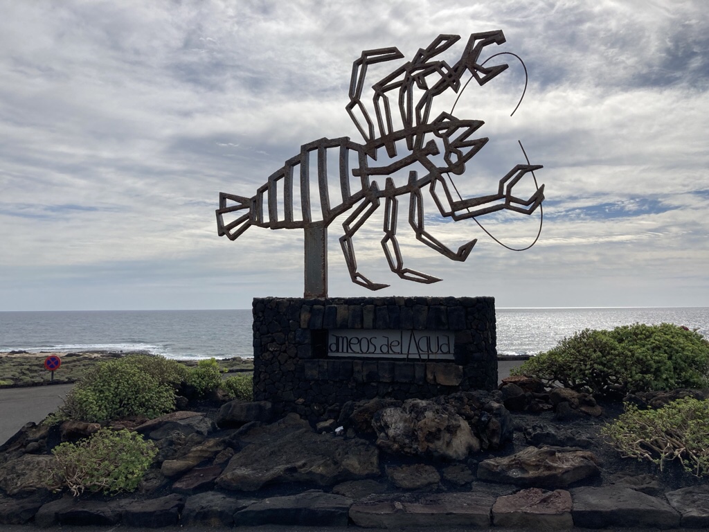
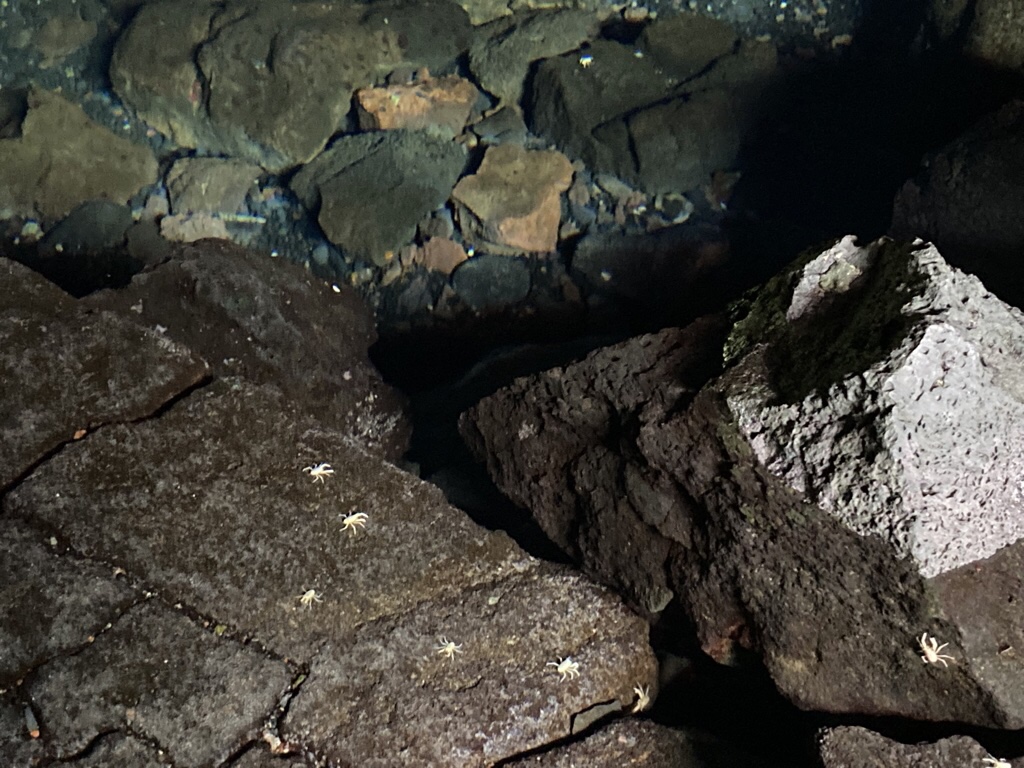
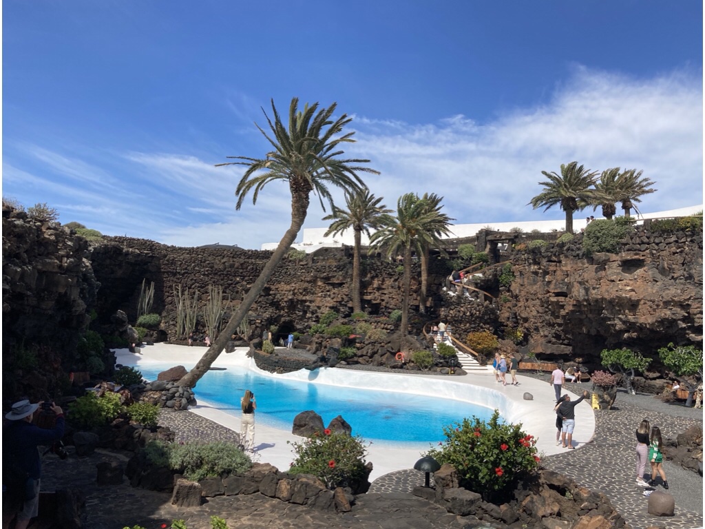
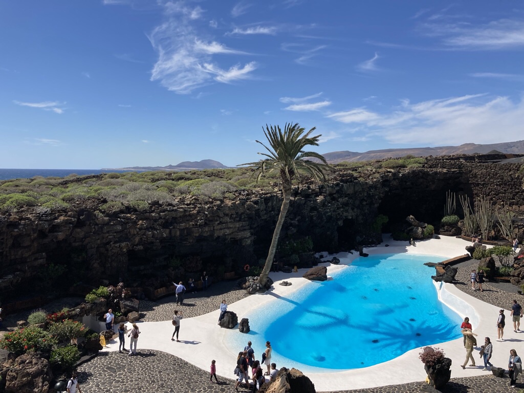
Just down the road is Jameos de Agua, where Manrique has transformed caves and collapsed lava tubes into an artistic showpiece where the natural beauty can be admired. The natural lake has extremely clear water and is home to a species of blind albino crabs known as Jameitos which are only found on Lanzarote.
Beyond the cave are gardens, another pool and an exhibition space, cleverly combining both traditional and modern styles.
Jameos must really come into its own on Fridays as the caves open for party night with an evening of drinks, dinner, a classical music concert by the lake then a DJ and dancing till midnight.
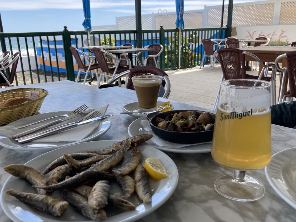
A stop at Punta Mujeres on the way back was perfect for a sardine lunch by the sea.
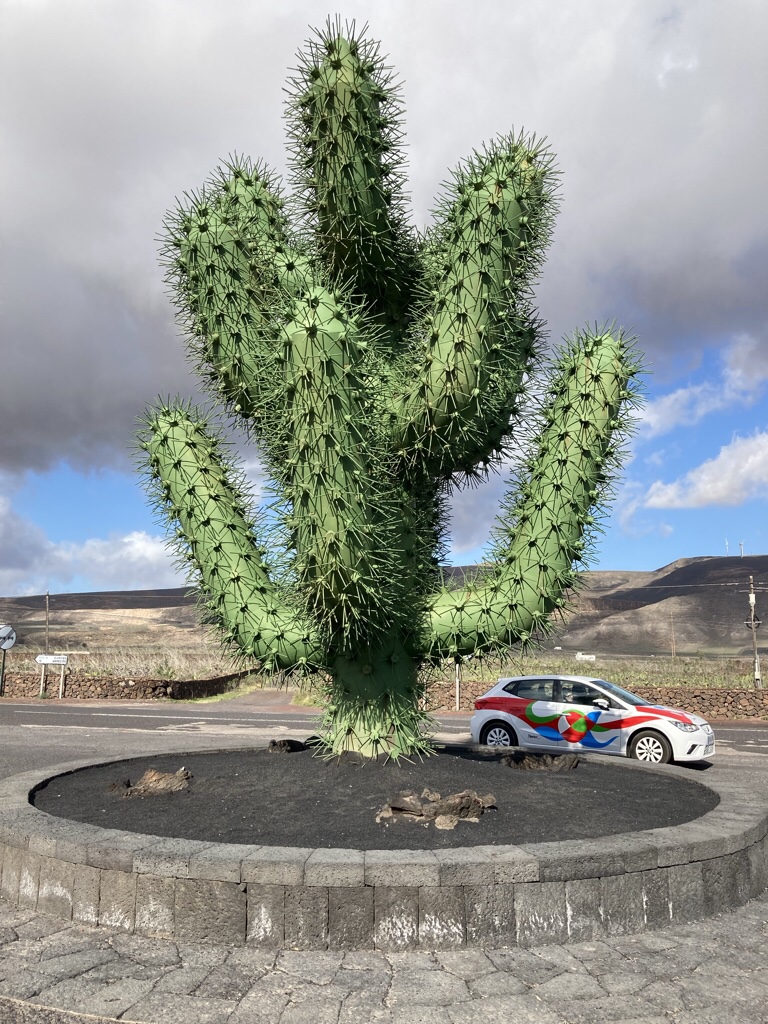
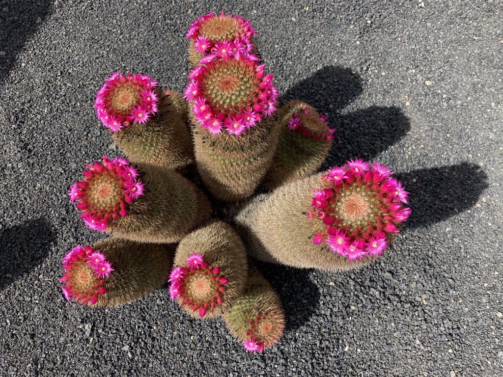
We visited The Cactus Garden on our last day, welcomed by this crazy green sculpture outside!
The cacti came in all shapes and sizes from all over the world. The architecture had all the features we had come to expect – volcanic rock, white curving walls, stylish metalwork, carved wood, a spiral staircase, lots of lush green plants, pools of water and huge windows all to enhance the star of the show … the landscape.
We ended as we’d started eating tapas with canary potatoes with mojo sauce and a lovely bottle of local wine grown in the volcanic soil, followed by a glass of Ron Miel or honey rum which finishes every dinner here beautifully.
So to sum up, we thought finding vegetarian food might prove difficult, which it was, and we were warned that Lanzarote can be windy, which it was, but the striking landscape couldn’t help but impress and together with the amazing work of César Manrique and bright sunny days far warmer than at home, Lanzarote has certainly ticked all the boxes for us.
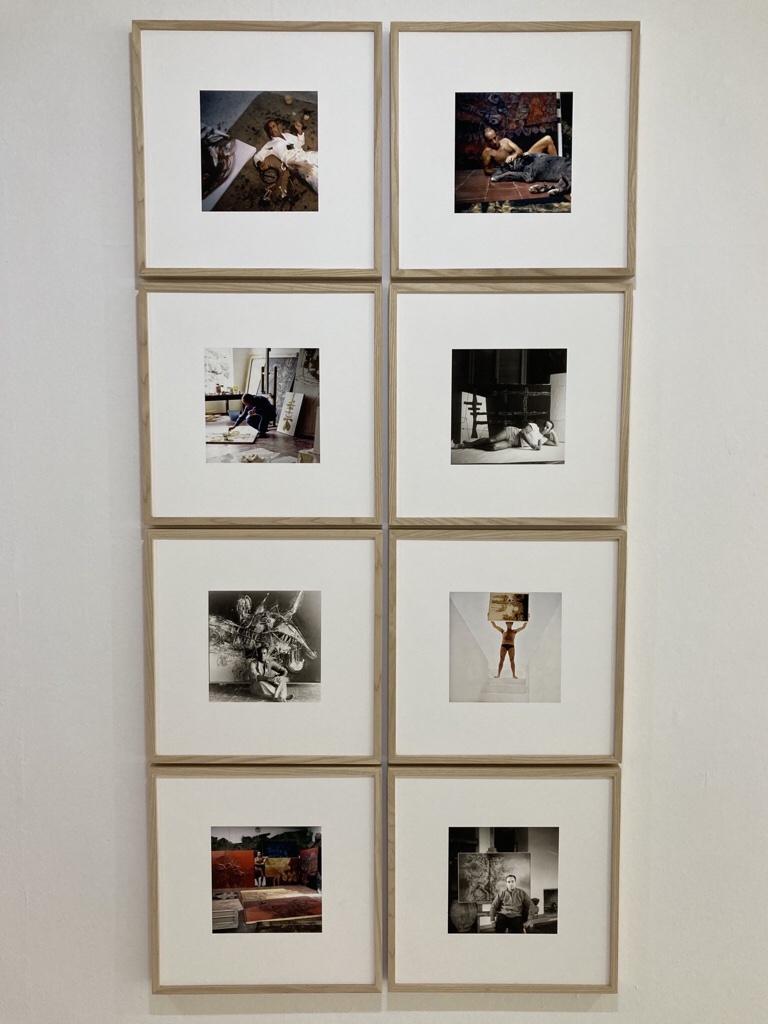
I knew nothing of César Manrique, Spanish painter, sculptor and landscape artist until I started reading about Lanzarote, and now we are here, he is everywhere. He was born in Arrecife in 1919, went Madrid to study art, then lived in Madrid and New York, and exhibited all around the world. He returned to Lanzarote in 1966 and became passionate about trying to ensure that tourism grew in a way that didn’t spoil the beauty of the island. He undertook a series of projects which aimed to turn the landscape and the island’s natural beauty into quality tourist attractions and also influenced planning regulations to prevent high rise hotels and to maintain the traditional visual unity among buildings on the island.
The first we saw of his work was the copy of ‘El Viento’ on our wall in Yaiza, which shows the wind blowing through the vineyards of the island.
This is just one of several murals on Lanzarote life which he painted for the original tourist office in Arrecife. We also found out that when Manrique decided to install an artistic centre on the island, he considered the building we were staying in, but instead helped to transform it into a restaurant specialising in Canarian food which was named for the old threshing floor, La Era.
At the exact centre of the island is the Monumento al Campesino, a cubist fertility monument to the Lanzarote peasant designed by Manrique and built by Jesus Soto made out of old boats and water tanks, depicting a farmer with his donkey and camel!
There is also a museum based on a traditional farmhouse, and we could see the threshing floor or ‘la era’, as well as other farming bits and pieces.
The cafe serves gofio, ground and toasted wheat or maize, once the island’s staple food. Chris had it blanched and served with onions and said it was ok, but I preferred mine served as a cold sweet paste with spice and dried fruit a bit like fudge, served as a side for my stew of the day.
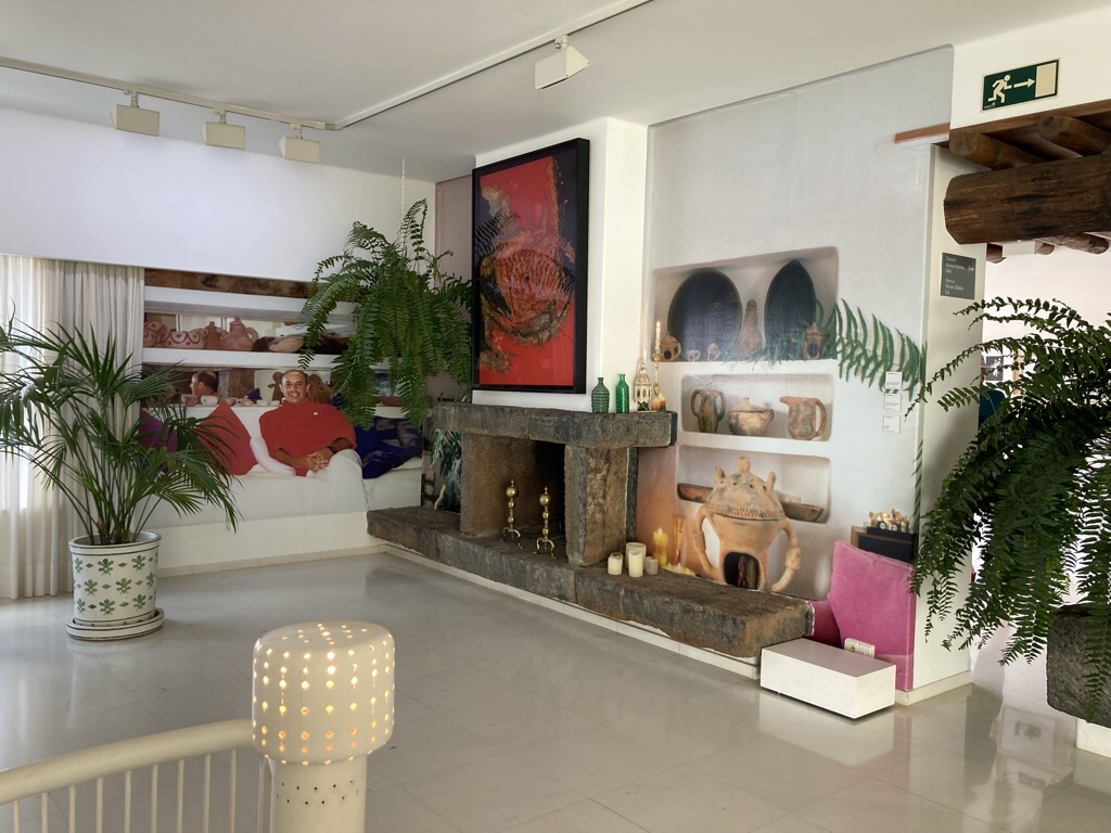
A trip into the capital of Arrecife brought our next Manrique encounter as we looked round the Castillo San Jose which he adapted into a museum of contemporary art.
Although there was an early piece by Manrique …
… I have to admit to being more impressed with the sympathetic incorporation of a cafe with great views across the harbour …
… and even a loo with a view …!
While there, we walked round the Charco de San Gines where we had a little lunch …
… walked along the front …
… and up to the Castillo San Gabriel, now a small museum of Lanzarote history …
… to the one high rise building on the island, the Gran Hotel, built to Manrique’s horror while he was away!
For the second part of our trip, we have relocated to Costa Teguise, a purpose built tourist resort just the other side of Arrecife, which we chose for being in easy reach of the rest of the island, with more restaurants and hopefully a wider veggie choice for Chris.
Interestingly, only the black sand at the back of the beach is local … the rest comes from the Sahara!
And guess what, Manrique had a hand in the planning here too, collaborating with the initial designer to make the central Pueblo Marinero, a collection of restaurants and shops built to resemble the vernacular architecture of the island. This seems commonplace today, but back in 1979, this was cutting edge stuff. Unfortunately, grand designs don’t always go to plan, and the original developers went bust! It could be said that later development deviated a bit from the initial ideal, but it’s still a low rise resort, albeit a bit sterile.
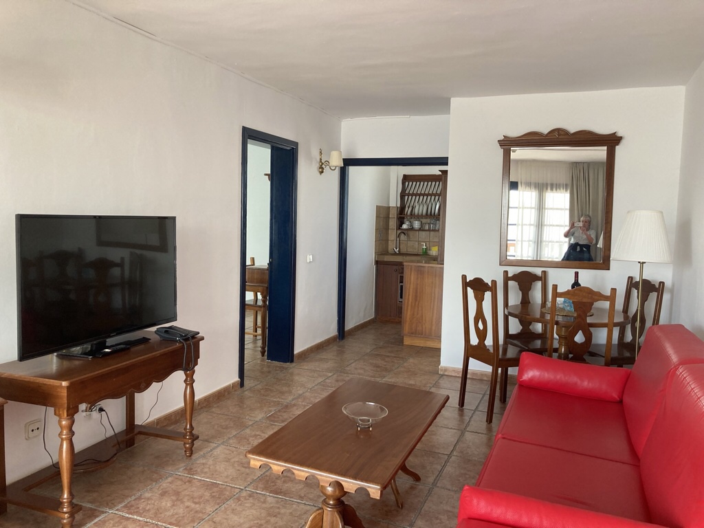
We stayed at Nazaret Mansions, an apartment complex round a pool and we had two rooms and a basic kitchenette where we managed to whip up breakfast each day and a couple of salads for lunch. The biggest bonus was the buildings shielded the pool from the wind, and it was easy to find a sheltered spot to sit and sunbathe, even if walking around required more clothes!
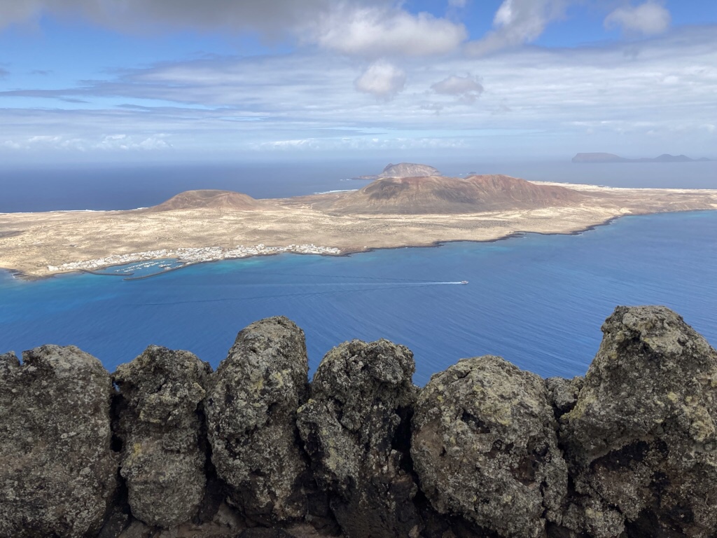
Not that we spent that much time soaking up the rays as there was so much to see. The Mirador del Rio is right at the north of the island, where Manrique collaborated with architect Eduardo Cáceres and artist Jesús Soto in a display of technical planning to convert an old gun emplacement on a cliff about 500m above the sea into a viewpoint and restaurant. We were greeted by a sculpture of a bird and a fish and an entrance that gave nothing away.
A curved corridor led us inside and then the panorama was revealed, though immense glass windows.
From the outer walkway, we could see the eighth island of the Canary Islands, La Graciosa in the centre …
… with the reddish colors of the Salinas del Río at the foot of the cliff …
… the rest of the Chinijo Archipelago to the right, but it was far too big to get in one shot!
There is a higher balcony and the restaurant is so well concealed, only the skylights are visible from above.
Just as before, the inside space was as impressive as the view, with lovely curving lines, natural materials, and special features such as the plants, each with a volcanic basin below to catch any water and sculptures including the ceiling lights.
On our way back, we stopped in Haria a sleepy town set in a palm filled valley …
… with a central plaza, a number of craft shops …
… and a cafe serving delicious bocadillos for lunch (my Manrique contained zucchini, smoked cheese, crispy ham and palm honey!)
No surprise that in 1986 Manrique chose to retire to Haria and started renovating a former farmhouse, making Palm Grove House his home until his death in 1992. The publicity material says it all … the home is a prime example of intervention in a dwelling representative of rural island architecture, reinterpreted by César Manrique from a contemporary perspective! The house is full of natural materials such as a timber ceiling in the bedroom and a huge basalt fireplace in the lounge, and is filled with his personal belongings. The dining room was part of a later remodel, containing a huge table, surrounded by glass and softened by huge green ferns. Unfortunately, we could only take pictures of the outside areas …
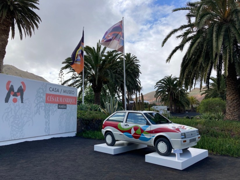
… and this 1987 SEAT España which Manrique was commissioned to paint. Interestingly one of the car hire companies on the island has just used the same design on 96 cars in its new fleet and I wonder if we’ll see any.
The final stop on the way back was at the Mirador de Ermita de las Nieves, built on the highest spot to the patron saint of the island and where locals come to pray for rain. We got a glimpse of Famara below as the clouds came up over the top of the cliff and buffeted the palm trees surrounding the church.
It’s taken a few days of relaxing in this lovely spot before I felt ready to start writing! We were never really sure if the trip would actually happen, it was postponed from last year and then we realised my passport had expired so we were on tenterhooks until the last week. Even the travel was strange, particularly sitting on a plane in a mask for 4 hours followed by a small glitch with my travel pass, but finally we are here, on our first trip abroad since Covid.
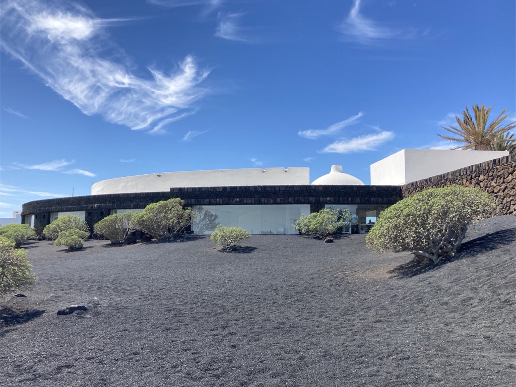
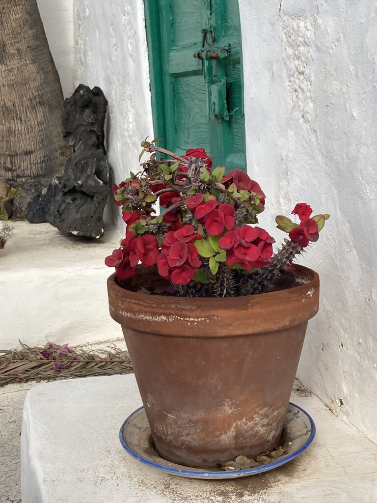
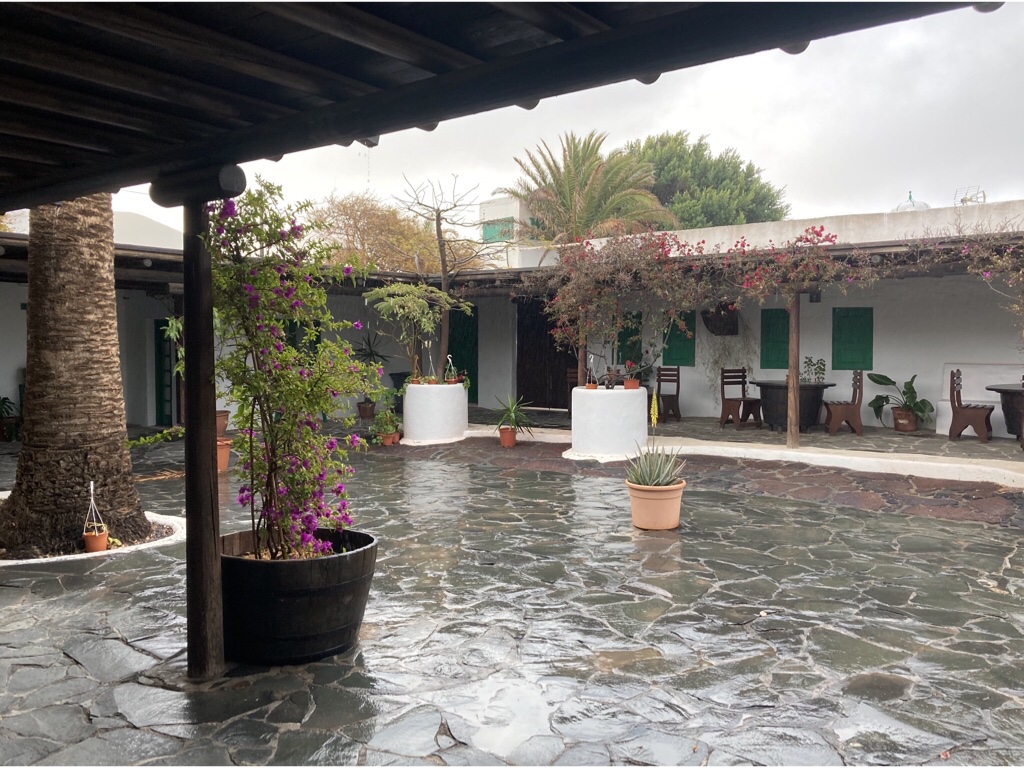
We arrived at Hotelito La Era in Yaiza just after sunset, seven rooms set round a patio with whitewashed walls and green paintwork like most properties on the island and filled with bougainvillea and cacti.
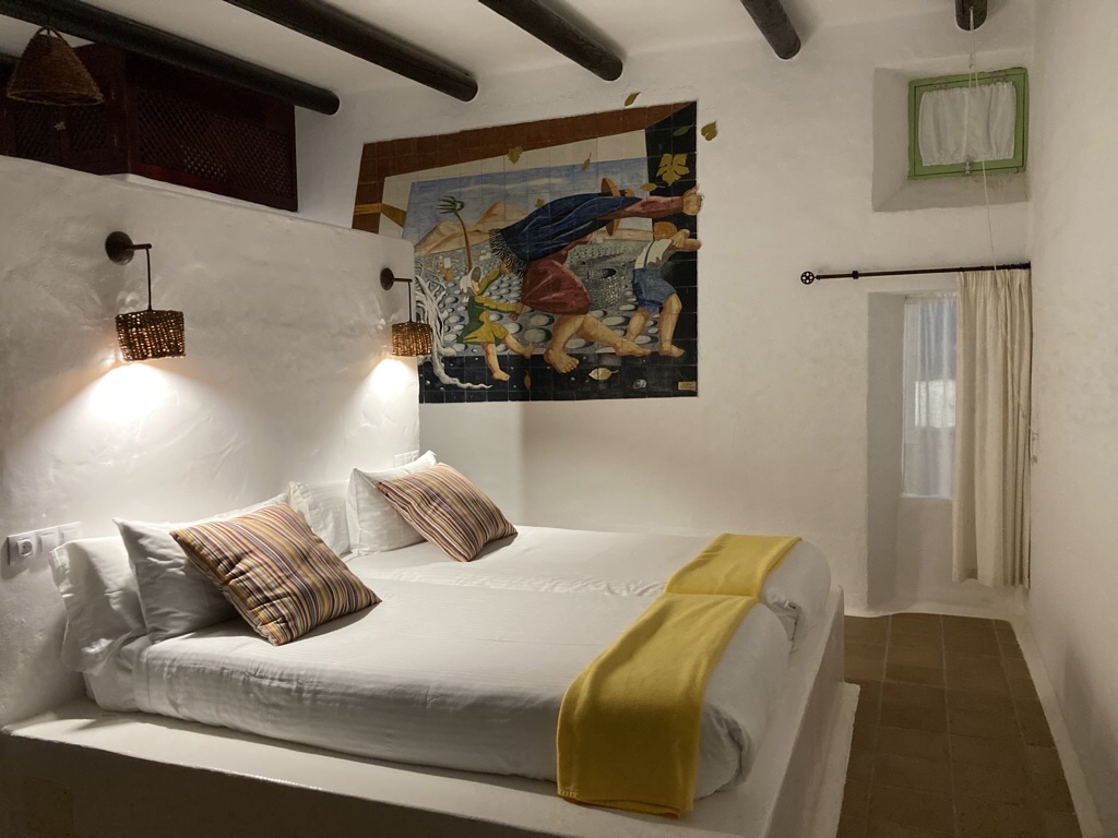
Our room certainly is simple but striking with the bed on a central stone plinth with the shower behind in a circular well. The beautiful tiled plaque of ‘El Viento’ from a painting by a local artist called Cesar Manique is a feature of the room and bright cushions finish it perfectly.
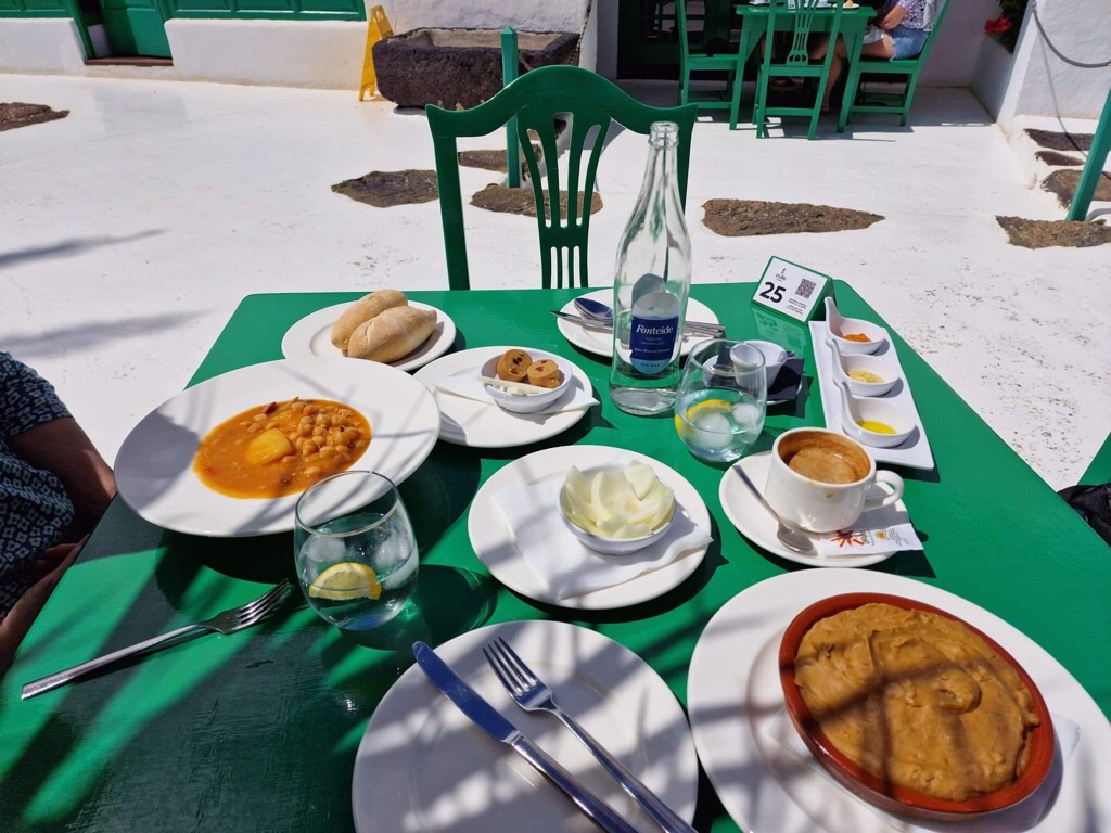
It’s lovely to be able to sit outside on the patio for breakfast in the sunshine, although it’s a little chilly and fleeces are required. As well as fruit, juice, toast, cake there is something savoury on a slice of bread that varies each day, usually including one of the local sauces called mojos and some cheese. The same mojo sauces reappear at dinner on small potatoes grown on the islands and cooked with their skins as tapas.
We’ve also enjoyed sitting out at the end of the afternoon, relaxing with a cold drink to read, write about the day, or even stitch! We ate in the restaurant a couple of times, and while there isn’t much vegetarian choice, with notice they cooked Chris a great dish of roasted vegetables with rice and quinoa, and I had a local chickpea and meat stew and also rabbit which was a real treat.
Yaiza is one of the prettiest villages on the island. There are only a couple of places to stay, not many more places to eat, although we found one other place, La Casona, which was very good. There is a small artisan craft centre selling jewelry made from lava, leather and ceramic goods and pansies preserved in resin! Lured into a boutique by coloured scarves, I actually chose a pink cotton jumper which has proved perfect in the cool evenings here.
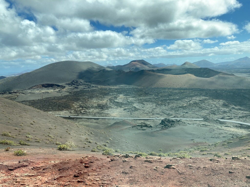
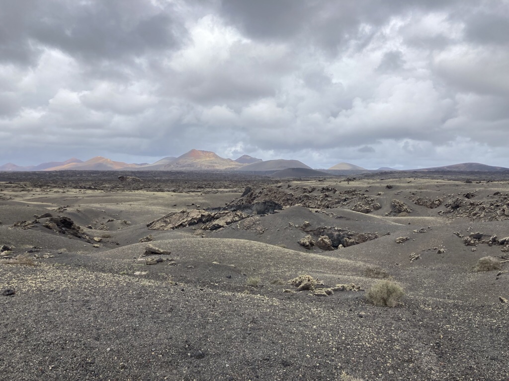
Lanzarote rose from the sea on a massive volcanic eruption some 15 million years ago, has been inhabited since prehistoric times but was claimed by the Spanish in 1402. Yaiza is just a few kilometres from Timanfaya National Park where some 100 volcanoes erupted between 1730 and 1736, with a smaller episode in 1824. The scale of the eruptions was enormous, with an unimaginable amount of lava spewing out and covering a quarter of the island, and making new land as it spread into the sea. Although no deaths were recorded, almost half the population emigrated as much of the most arable land was buried under a thick crust of basalt.
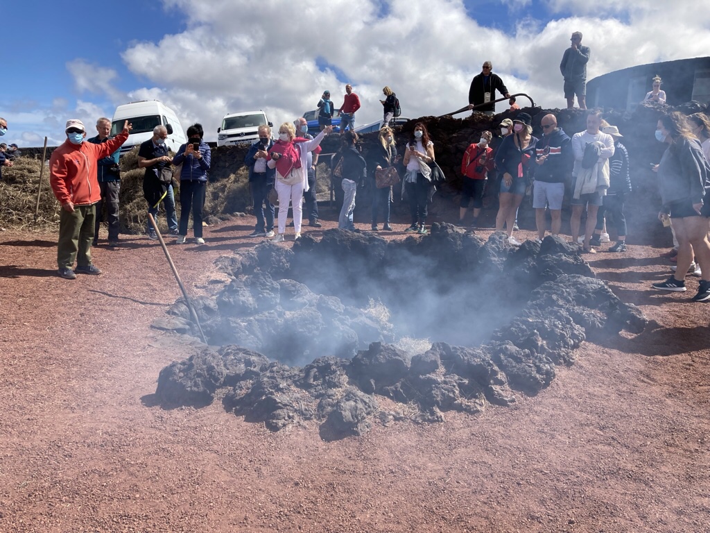
We visited the Montañas del Fuego Centre early to avoid the queues and were welcomed by the image of El Diablo as we arrived.
They are called the Fire Mountains as they can look red as the sun rises and sets.
Although volcanically dormant, it is still hot underground and we saw water poured into the ground which then produced a geyser of steam and straw that ignited just by being left on the ground.
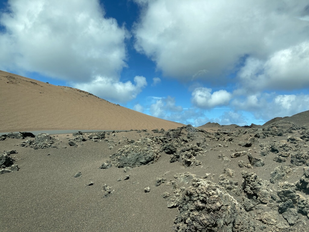
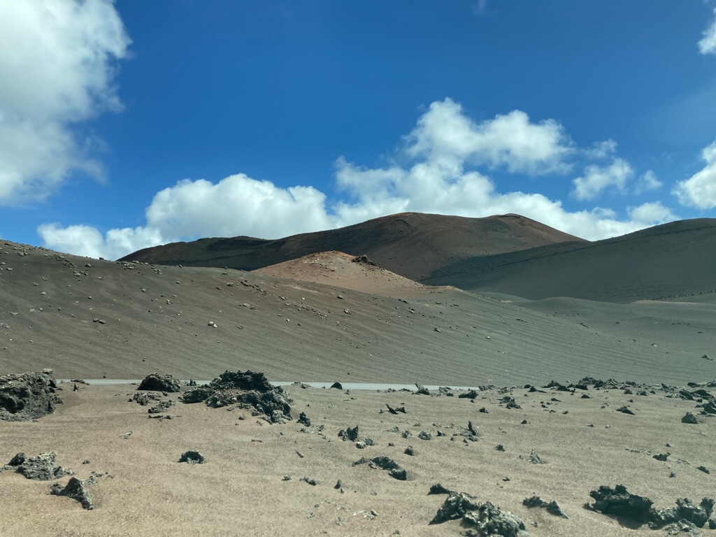
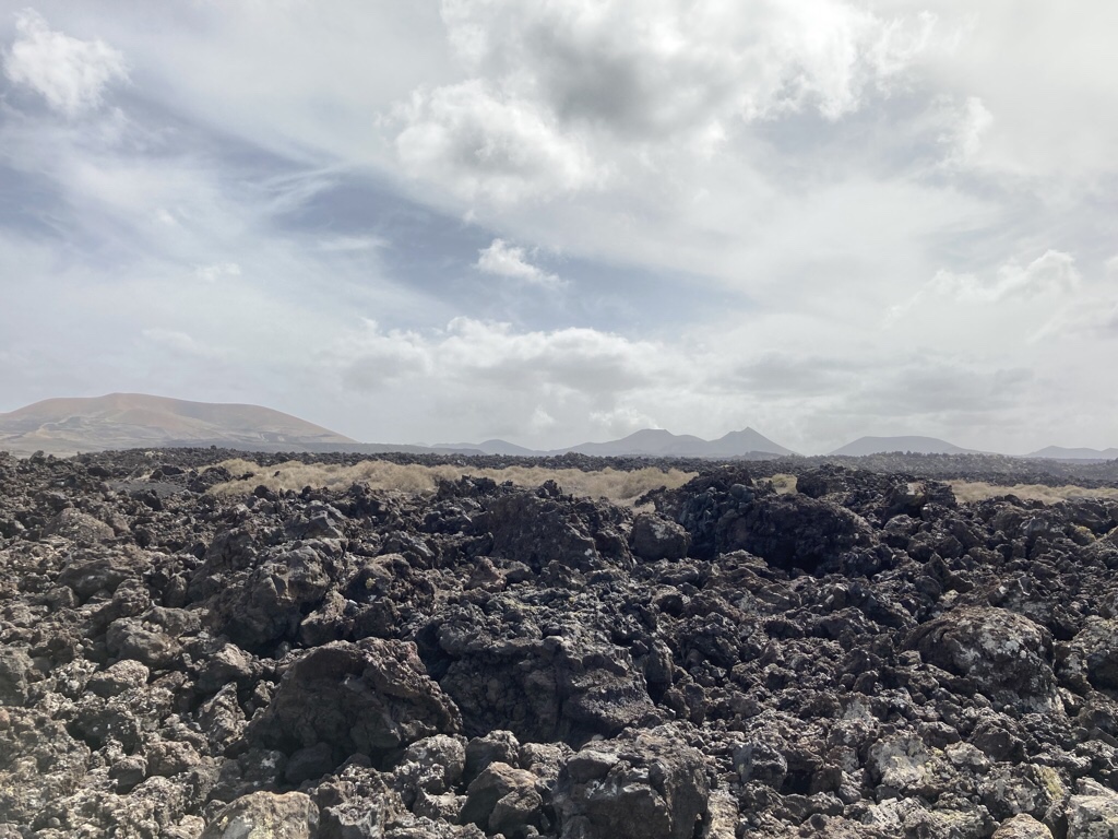
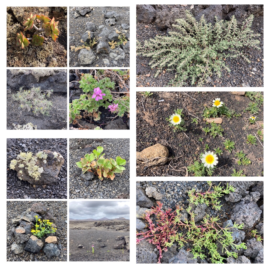
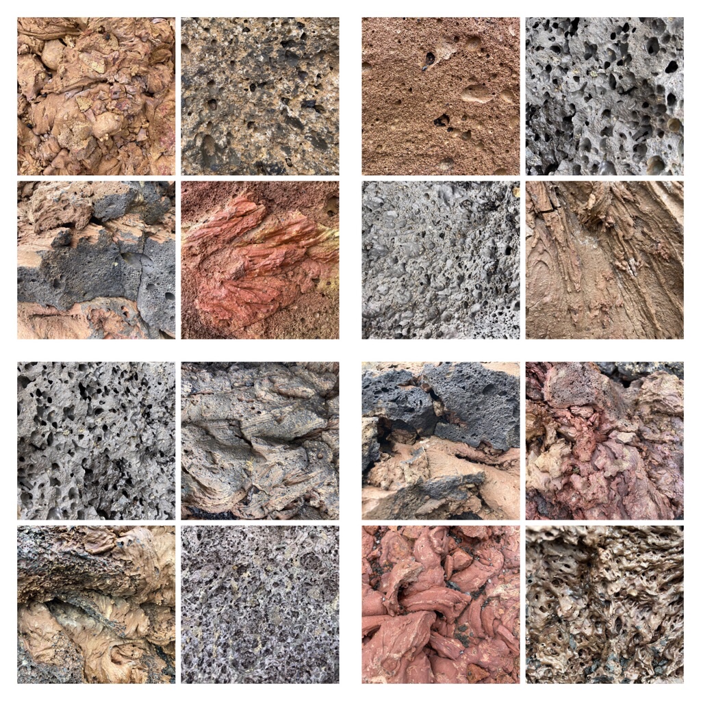
The volcanic surface may look barren, but a surprising number of lichens and small plants survive there and access is limited so we took the bus tour which was excellent, even if photos taken through the window weren’t great. The extent and variety of the landscape was striking, with huge ash covered areas interspersed with lava of all colours and textures creating moonlike vistas.
The other way to visit is by camel, and we watched groups returning on their beasts. I thought the camels were just for the tourists, and today they are, but they were brought to the island in the C16th and were used for all types of agricultural and transport work until well into the C20th.
Few of the roads have places to stop so photo opportunities are scarce but we read about the palmera inclinada and wondered if we’d be able to park nearby. We were in luck and walked down a well worn track to this quirky palm, star of many Instagram snaps! We had to join in and took a couple of our own!
As always, I snap the flowers and plants along the way, but this afternoon, I lost my balance when photographing a plant and fell on my bum, which was ok, but I grazed my hand on the volcanic rock and spent the rest of the day feeling a little sorry for myself for being so stupid and because it stung. I’d only taken off the skin, but it took several days to start healing properly, and just brought home how lethally sharp the volcanic rock is.
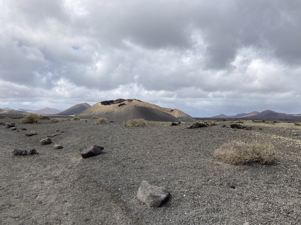
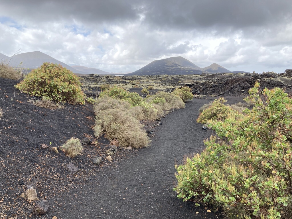
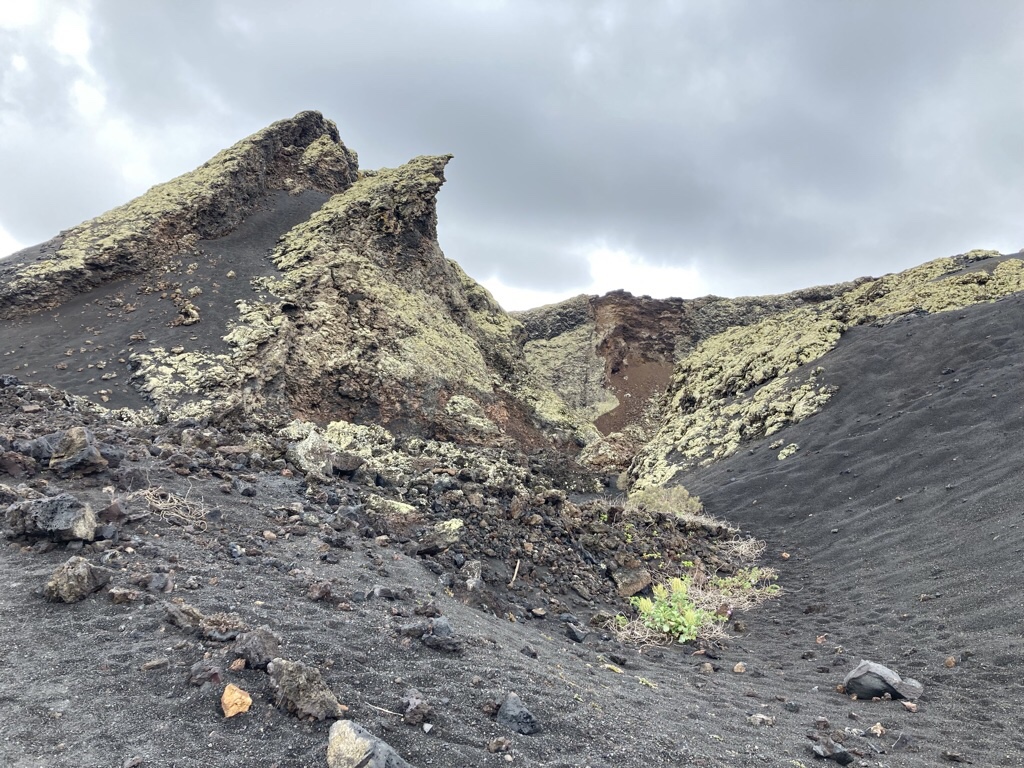
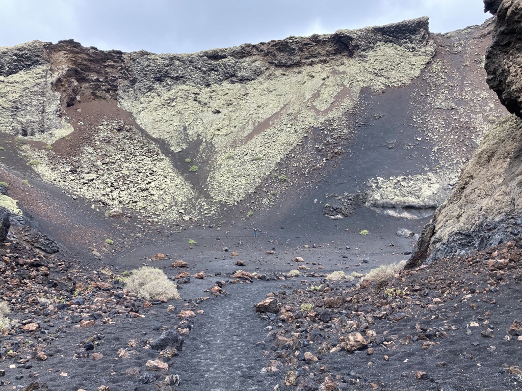
As for hiking, we decided to keep it to a minimum this trip as Chris has a dodgy knee, but nonetheless, the lure of a volcano we could actually get inside which would be on the flat, and only a round trip of about 3 miles from the car park won our vote. La Caldera de Los Cuervos was the first volcano to emerge from the eruption of Timanfaya. A path has been set up which offers great views of the lava flow, the crater and the surrounding area and enables a safe and sustainable visit. As we got closer we could see the splatter of lava at the top and the thick layer of small particles called pyroclasts down the sides. In a windy place like Lanzarote, these build up more on the leeward side which affects the shape of the volcano.
The number of plants getting a foothold was surprising, with even a lone poppy managing to survive in the wind.
Once inside the crater, it is huge … can you spot me?
We took several pictures inside …
… and were amazed at the variety in the colour and texture of various bits of lava …
We were so pleased we did the walk, even if it means a little R&R tomorrow.
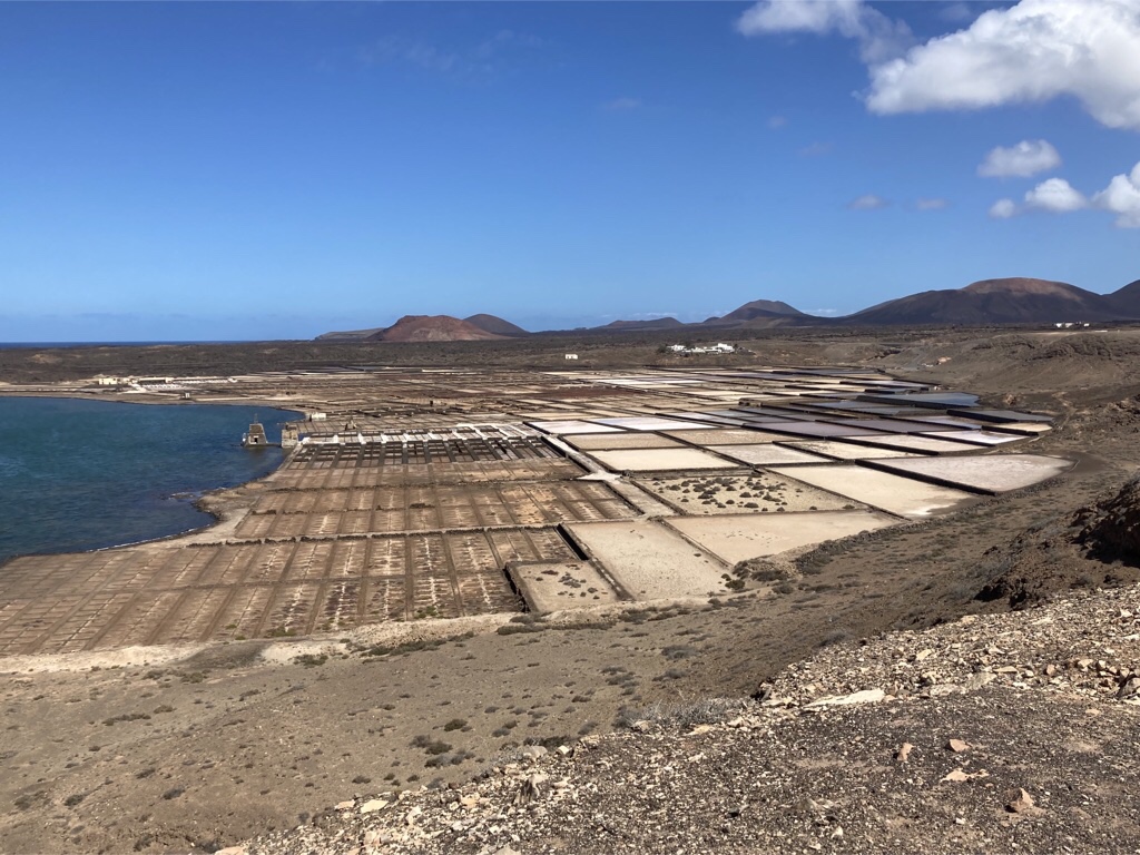
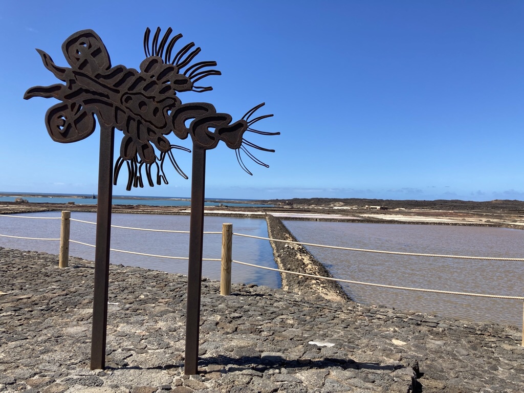
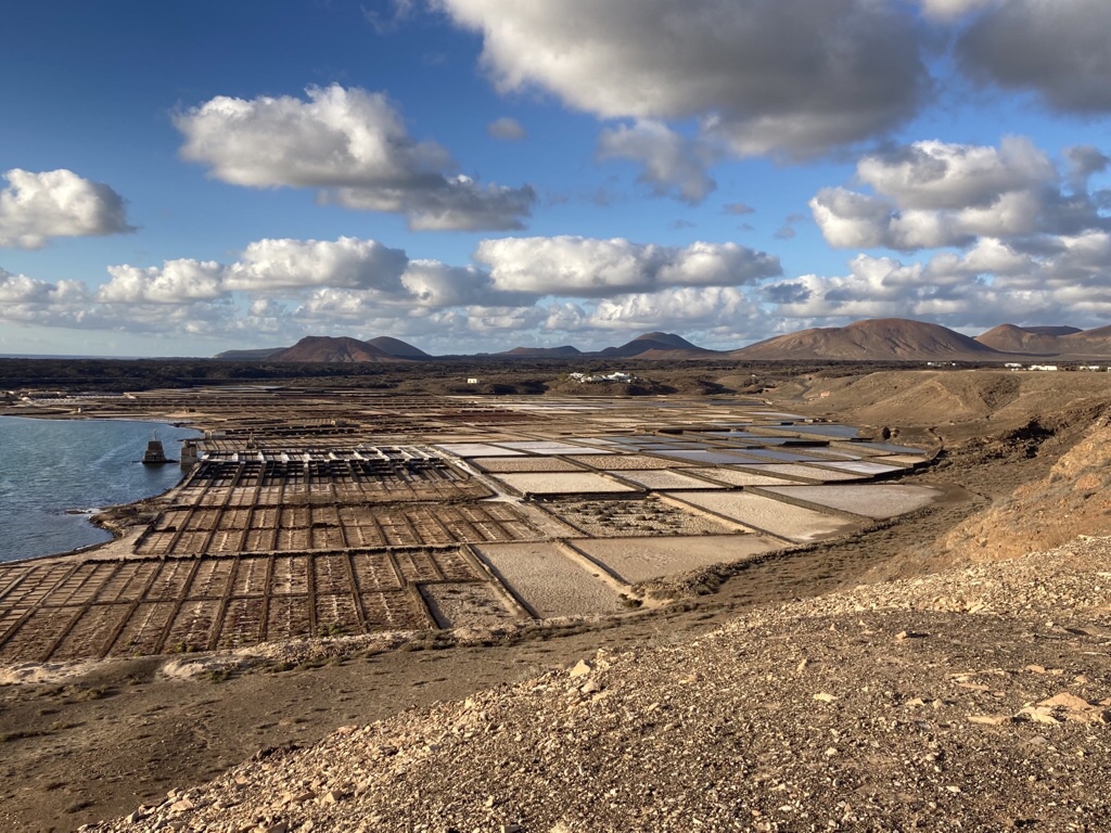
From Yaiza we also explored the closest stretch of coast, starting with the Salinas de Janubio. The lava had formed a natural lagoon and salt flats were created which once produced 10,000 tons of salt a year, used mainly for conserving fish but production decreased considerably after refrigeration was introduced.
The logo for Canarian Salinas was designed by Cesar Manrique, inspired by the Artemia Salina, a small crustacean which can survive in the salt pans.
We even came back here one evening for dinner, took some photos in the afternoon light …
… and watched the sunset as we tucked into vegetable paella.
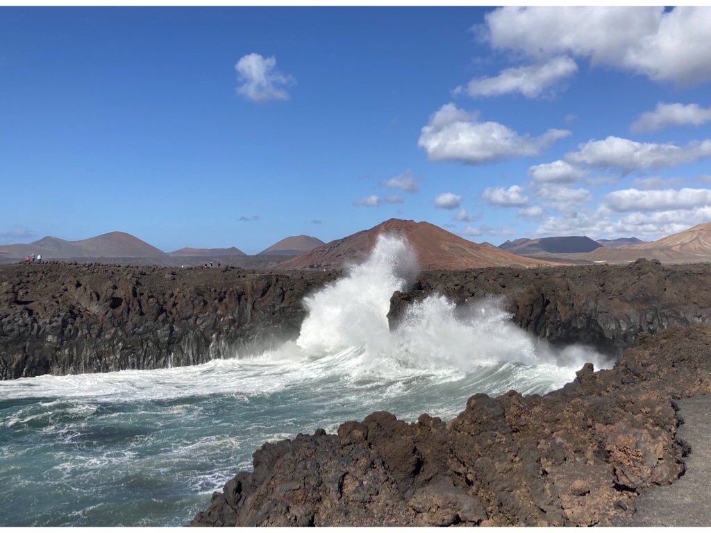
Further round the coast is Los Hervideros which means ‘Boiling pots’ because of the how the waves crash and swirl in the caves which have been formed in the lava by erosion.
A path goes quite close to the edge, but walkers beware as many received an unexpected dousing from a rogue wave. The colours were striking with the deep blue water and the red Montana Bermeja in the background.
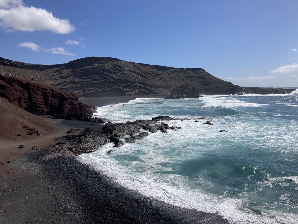
The small seaside village of El Golfo proved a perfect place to stop for lunch, in one of the seafront tavernas offering garlic prawns for me and an omelette for Chris. We lunched to the constant sound of the huge waves crashing onto the rocks.
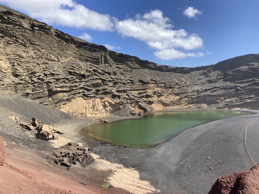
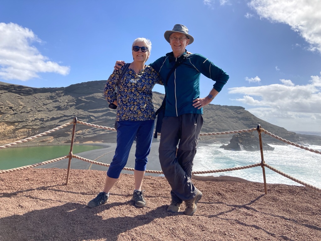
Afterwards, a short walk took us to Charco de los Clicos which is the eroded crater of a volcano which has been left open to the sea.
It has a permanent lagoon which keeps its water level through underground cracks and is green due to sulphur and algae and is separated from the sea by a black sand beach … all in all quite a photo opportunity although it’s almost impossible to get it all in!
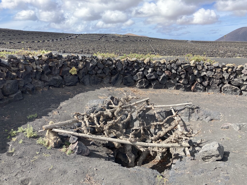
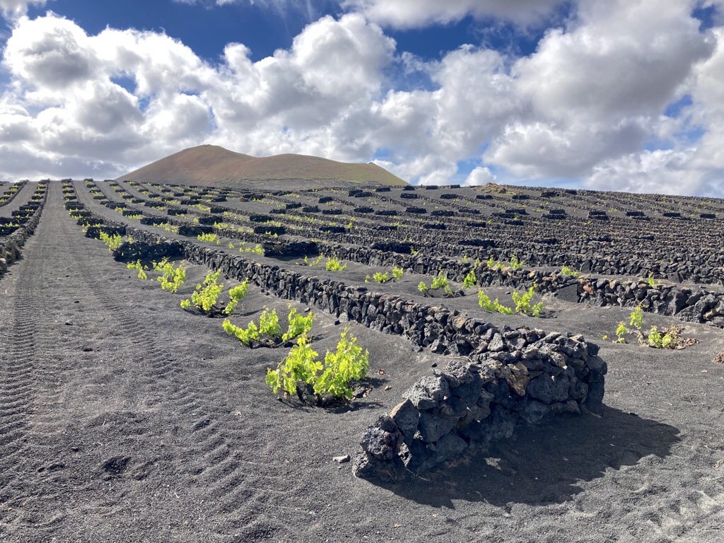
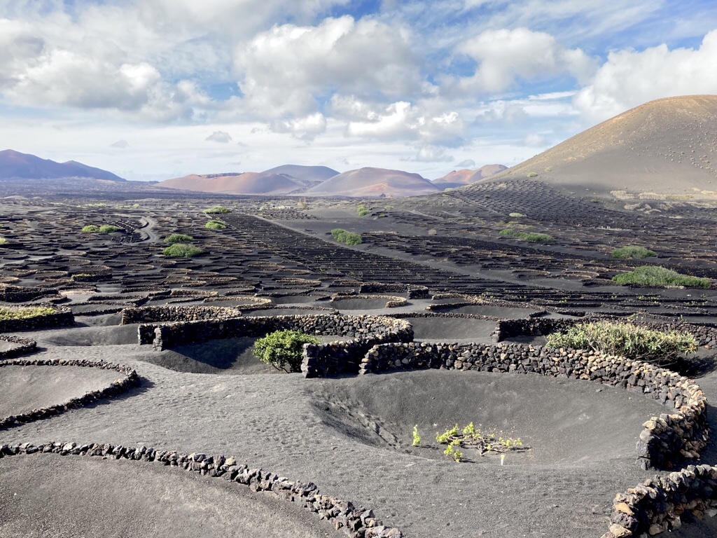
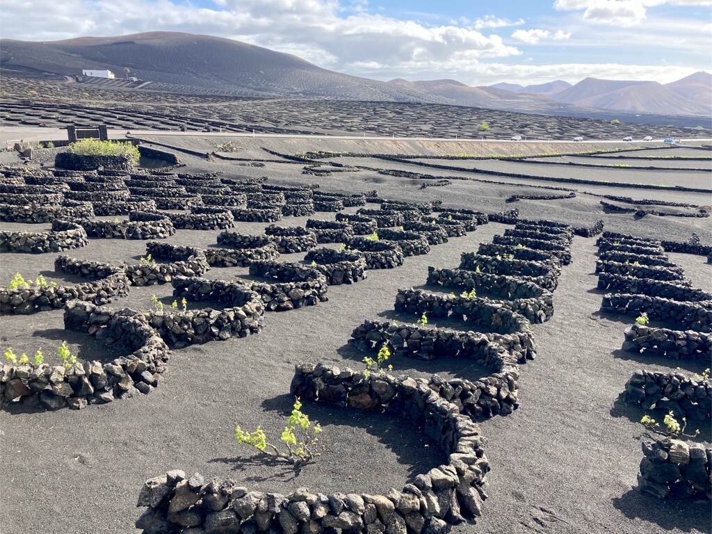
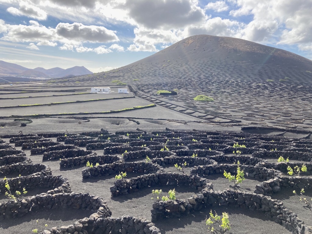
It isn’t just the sea that fights back against the lava. Local farmers fought back too and managed to use their ingenuity to get vineyards established here. Deep hollows are dug through the ash layer into the soil below and the vines planted. They are protected from the strong north easterly trade winds by curved dry stone walls called zocos. The black volcanic ash is a vital element, capturing and storing what little moisture is available, and regulating the temperature of the soil. It is striking to see rows of these abstract forms lining the hillsides and the contrast of the green vines growing in the black soil.
We visited El Grifo first, the oldest winery still operating on the island.
Here we saw some very old vines planted in pits …
… and others in rows …
then at La Geria, protected by the iconic curved walls.
We’ve had a couple of bottles of El Grifo wine and can report both the red and the white are excellent.
On our last day in Yaiza, we woke to rain which was a bit of a surprise. It didn’t last long but it did mean we had our last breakfast indoors.
This brings the first part of our trip to an end as we leave Yaiza and drive to Costa Teguise, halfway down the island on the south coast for the rest of our stay.
After two years of Covid, it appears to finally be time to dust off the passport and venture forth!
Most of our travels have involved city breaks, touring or long haul but right now we needed a different approach. We wanted somewhere not too far, with reliably warm weather and acceptable Covid restrictions which suited self drive and an exploration of the great outdoors.
Lanzarote was the winner, and while I had been to Tenerife as a youngster, Chris hasn’t ventured to the Canary Islands before. We are looking forward to the sun recharging our batteries and enjoying a landscape which might suggest we are on a different planet.
We are both intrigued by the photo opportunities of black sand, white buildings and green cacti and also finding out about César Manrique whose artistic career has left an indelible imprint on the island so why not come along as we go off travelling together!
The day dawned on our 10th Wedding Anniversary and having exchanged cards and had breakfast we drove to Fowey.
We held our wedding reception onboard a boat on the Thames between Runneymede to Windsor and have celebrated with a boat trip every year since. Mind you, trying to find a scheduled public boat trip in October can be a challenge so I was disappointed that the daily Mevagissey to Fowey service only runs till the beginning of October. Reading more about Fowey, I realised it also ran river ferries, similar to the ones we had ridden on in Dartmouth a couple of years ago. The plan all came together when I saw The Hall Walk, billed as a spectacular circular coastal walk through woodland and creek, with striking views of Fowey Harbour linked with two ferry rides!
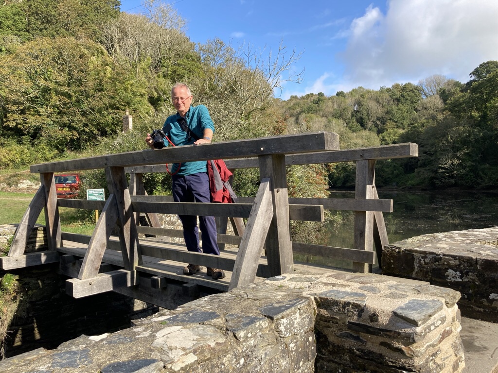
We parked in Fowey and faffed a bit with clothing as it had started to drizzle enough to realise going off without a coat would be foolhardy and it was also a bit chilly. This is the car ferry which crosses between Fowey and Bodinnick …
… and this the crossing and the blue and cream house on the opposite shore is Ferryside, another former home of Daphne du Maurier.
The walk was well marked as we climbed up on the other side then through a gate onto a path which ran round the creek of the Pont Pill, which is Cornish for the creek of seal cove.
It joins the River Fowey at Penleath Point where there is a memorial to Sir Arthur Quiller-Couch and great views of Fowey harbour.
So much for a waterproof and fleece as it was chilly … the sun soon came out and before long both were tied inelegantly round my waist for the rest of the walk!
We continued through the woods, particularly noticing the buzzing of insects in the air as they feasted on pollen from the English ivy which was flowering all around, then down to the hamlet of Pont.
The river quay remains, and would once have been busy with barges sailing up from Fowey to unload their cargo and to take on board produce from the farms.
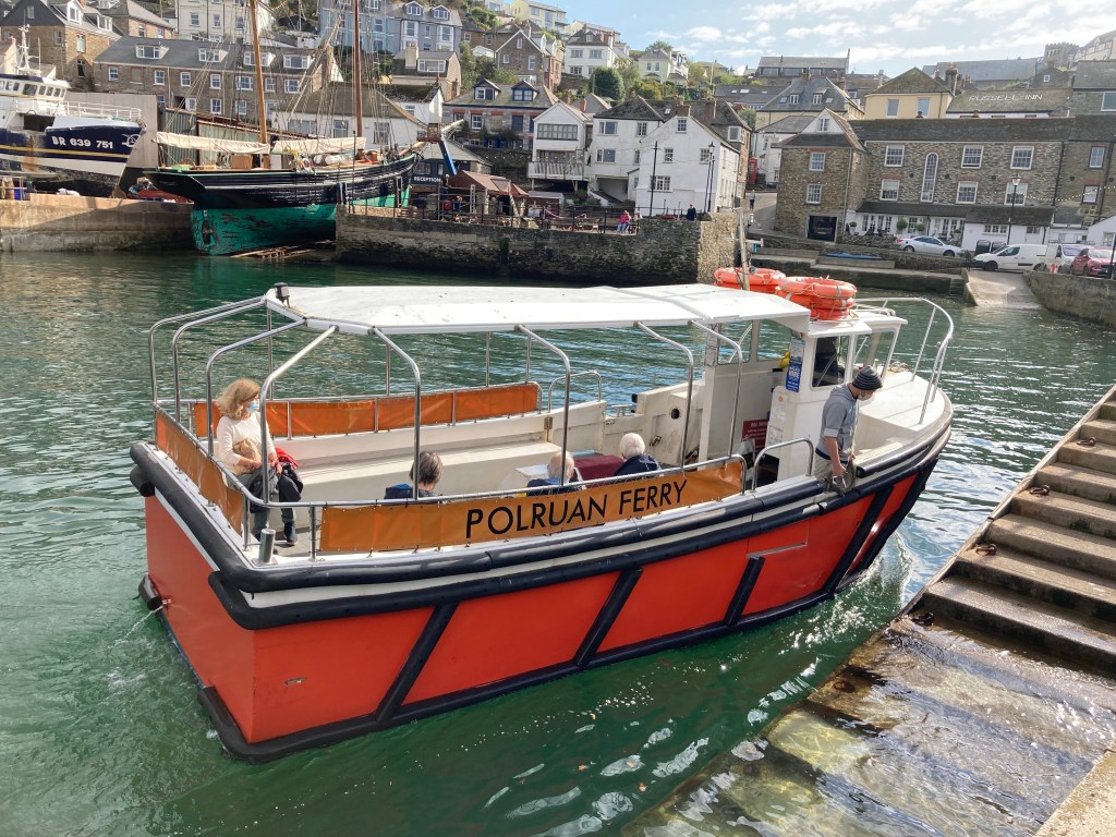
We crossed the bridge and the path rose on the other side and continued along the creek until we reached Polruan where we followed the maze of narrow pathways down to the harbour. Shipbuilding and repair has always been an important trade here, and remains so today and we had a look round as we waited for the little ferry to return …
… which then took us over the river to the Town Quay in Fowey.
Having worked up a bit of an appetite, we stopped at the Lifebuoy Cafe for sandwiches, and I was delighted to find crab on the menu, then we wandered round the shops before completing the loop and returning to the car.
On the way back, we stopped at Charlestown in St Austell as we’d seen it signposted and found out it has a late Georgian working port. It was built around 1800 by Charles Rasleigh to export copper and import coal but was soon being used for the export of China Clay. A complete village grew up round it with sheds and warehouses for pilchard curing, shipbuilding, brick making and lime burning, elegant Georgian houses and small fisherman’s cottages. Much of its character has been retained and so it’s a popular filming location having featured in Poldark and Hornblower among others.
Having said all that, it just seemed to be a collection of buildings each selling something or other to eat with a few boats for decoration, and we only lingered briefly, somewhat disappointed.
Once back, one task remained, to purchase a souvenir of our trip. We had seen ceramic fish adorning the wall of the Sharksfin the other evening, and had glimpsed the same fish in a shop in town when we were walking one evening, so went fishing! Sarah Hunkin is a local lady who makes all her own ceramics in her pottery studio in town and we went and bought a small shoal that we will release to swim across the wall in our kitchen!
In the evening we cracked open a bottle of fizz to celebrate …
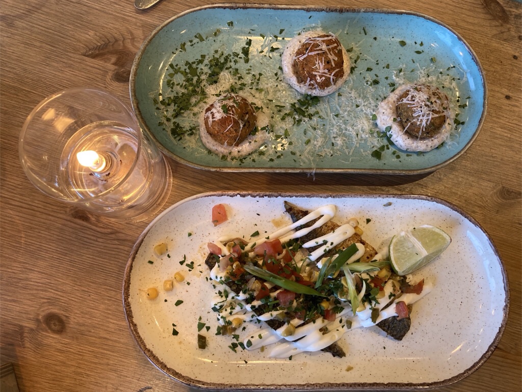
… then went for dinner at Salamander, a small restaurant owned by Mark and Hazel. All the food was delicious and it was a perfect place to have chosen. We had hot crab pot and breaded Cornish Camembert with spicy banana ketchup first, then pan fried hake with lemon and dill sauce and pumpkin & apple falafel with saffron and herb risotto and finally a cappuccino creme brûlée … and two spoons!
We saw signs earlier in the week that Meva Shanty Fest was on this weekend and while official events didn’t begin until tomorrow, there was singing in the pubs on our way home and we stopped at The Fountain and The Wheelhouse to listen, a perfect end to our Cornish celebration.
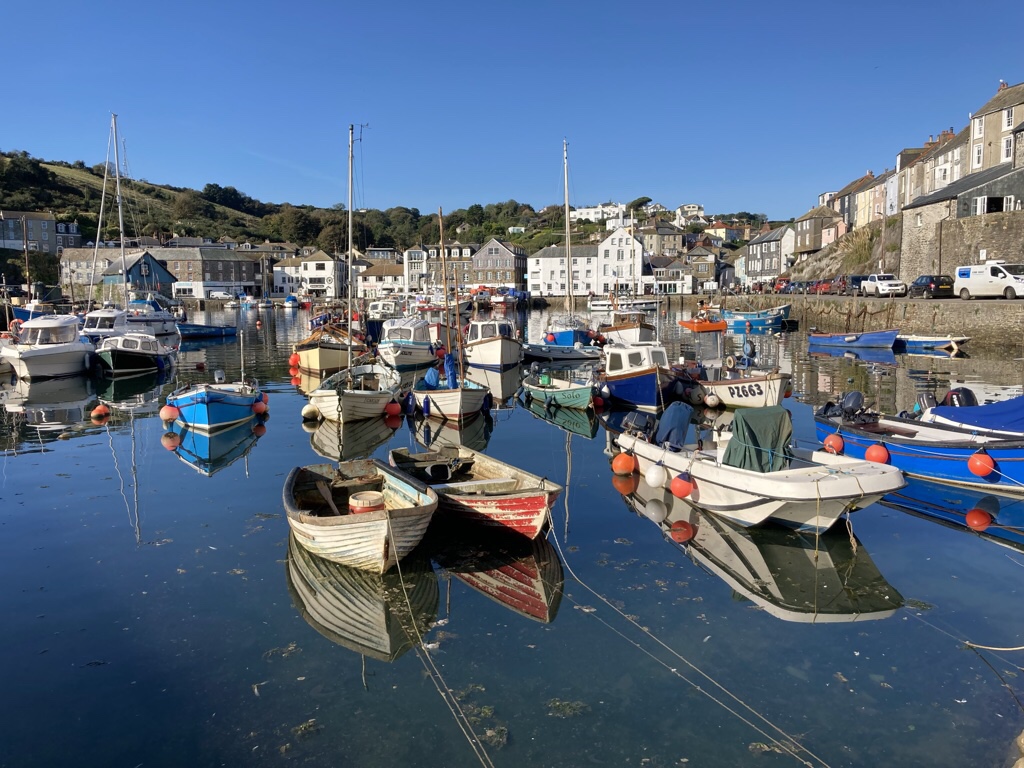
Bit of a change in the weather today as we awoke to fog, and sitting drinking tea we noticed the fog horn from the lighthouse sounding every minute. Once we were up and out, we took photos round the harbour, amazed at how quickly the fog lifted once the sun came though.
We had been keeping an eye on any boat trips being offered, hoping we might be able to take one on our wedding anniversary tomorrow, and saw signs for 45 minute cruises from Seas the Day.
I spoke to the lady selling tickets and she said while the boat was running today, it wouldn’t be tomorrow, so I decided to seize the day and book for the next trip, especially as she pointed out the seats came with cushions and blankets and there was a lovely seat for two at the back of the boat!
We had a lovely time, getting a different perspective from the water and exploring a short way each side of Mevagissey.
We were even lucky enough to see dolphins and Chris got the best photo …
On the way back I was sure I spotted a seal in the water and the captain said it was quite possible as they live along this stretch of coast … and before we knew it, we were back in Mevagissey.
It was turning into an action packed day as we spent the afternoon at the Lost Gardens of Heligan, just up the road. The estate has been owned by the Tremayne family for over 400 years, but the death toll brought by WWI led the heir at that time to forsake it and the gardens became lost before being restored in the 1990’s. I can remember visiting maybe 20 years ago, thinking it needed more time for the garden to establish after all the restoration that had been done. Well it’s certainly established now! Walking round the jungle garden, you would be forgiven for thinking you were somewhere entirely more exotic, with huge gunnera and tree ferns and lots of other lush planting showing just the right amount of exuberance without looking unkempt.
There are some modern garden sculptures in the undergrowth like Giant’s Head and Mud Maid …
… and also formal gardens, a large kitchen garden and extensive areas of woodland for the energetic – all in all a great visit.
We ended our lovely day with dinner at Sharksfin, an excellent meal with starters of mackerel and mushroom arancini and mains of sea bass with mussels in a creamy harissa sauce and spicy roasted cauliflower tacos with Cajun fries while enjoying a view of the harbour as the sun set.
As we wandered round the harbour to aid digestion, I mused that we’d had such a lovely day, I hoped we hadn’t peaked a day early, but Chris said we were bound to have just as good a day tomorrow!
Another sunny day in and another coastal walk! First we walked down to the harbour so get a few groceries and pasties for supper … and aren’t the little boats looking cute today!
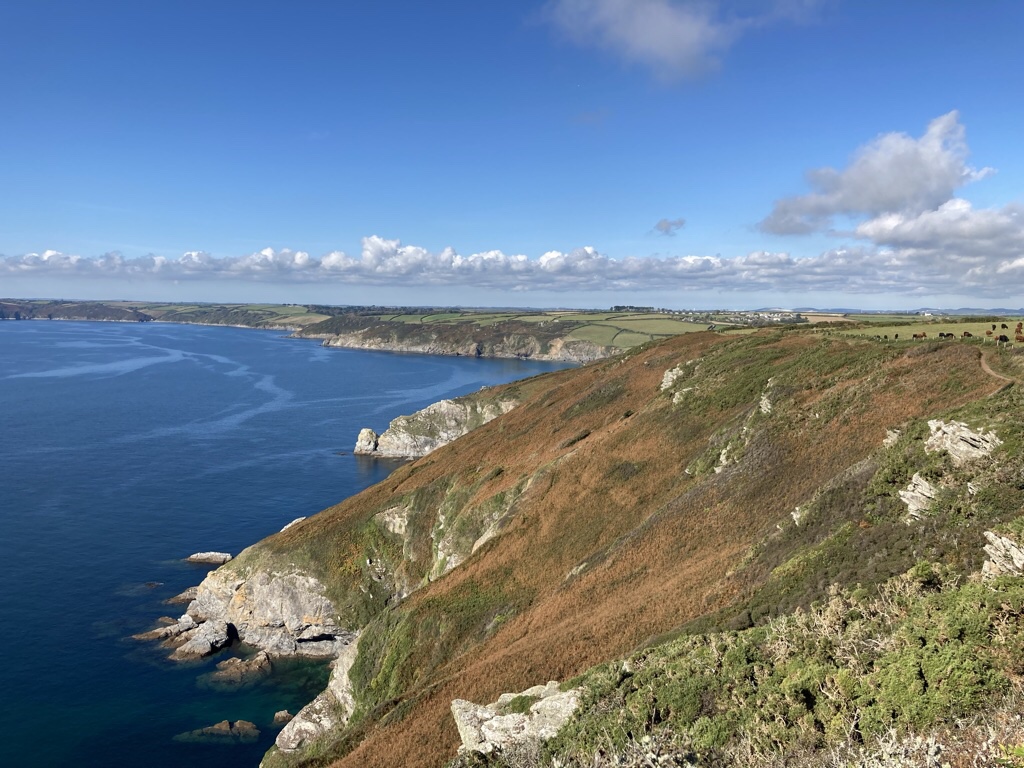
We then drove south from Mevagissey to the National Trust car park just outside Gorran Haven, down a rather narrow lane, so we were pleased we didn’t meet another car! Our walk was a circular route round Dodman Point, the highest headland on the south cornish coast, beginning with a descent to the very pretty Hemmick Beach where we lingered and took photos.
A pretty steep ascent followed, before it flattened out, but it was well worth it for the views.
I got a bit sidetracked by thorny windswept trees after seeking them out in the Yorkshire Dales and snapped several along the way.
At the point, there are earthworks remaining from an Iron Age Promontory fort and also a granite cross erected in 1896 to help navigation. It is a convenient seat for picnickers who were definitely taking their time over lunch, but you can see the view across Veryan Bay, with Gull Rock offshore and the Lizard Peninsular on the horizon.
Looking down there was some movement in the water which others said was dolphins, but we couldn’t see anything definite.
We continued along the coastal path for a way until we saw the sweep of Vault beach …
… and a pony grazing …
… before turning inland and returning to the car park.
We drove done to Gorran Haven and where the village store made us some lovely filled rolls to take and eat in the sun.
In fact, it was so lovely, I walked back to the car for our little chairs and we sat on the beach in the sun for an hour or so, then we had ice cream before we left … mine was clotted cream and blackcurrant … yummy!