Housesteads Roman Fort

We woke to steady drizzle interspersed with heavy downpours and the weather forecast said it would rain all day, but be dry tomorrow. We gave in and picked up our books and spent a couple of hours escaping!

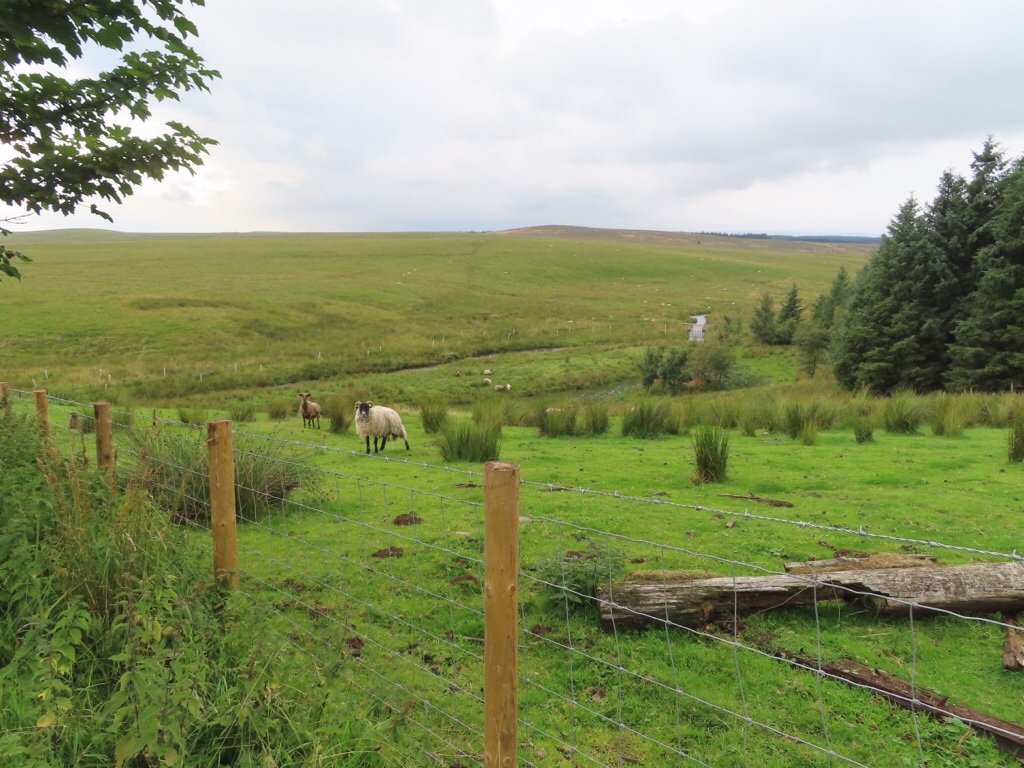
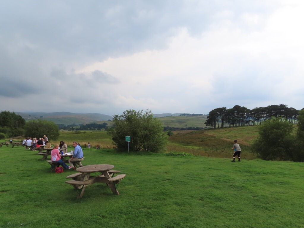
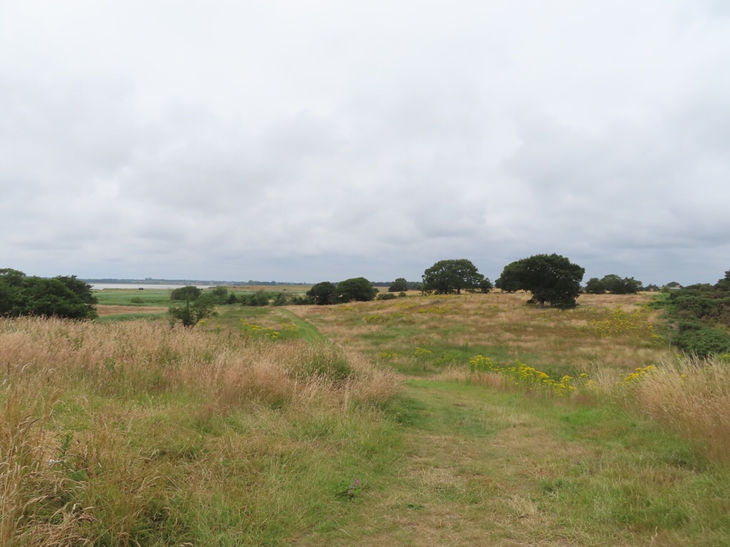
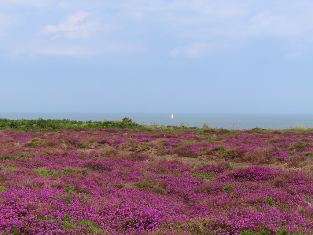
Some time later, the sky had brightened, so we thought we’d venture out and see how we got on. On our way back to the main road, we stopped to take photos of the clouds, the hills and the sheep and just admire the huge landscape all around us.

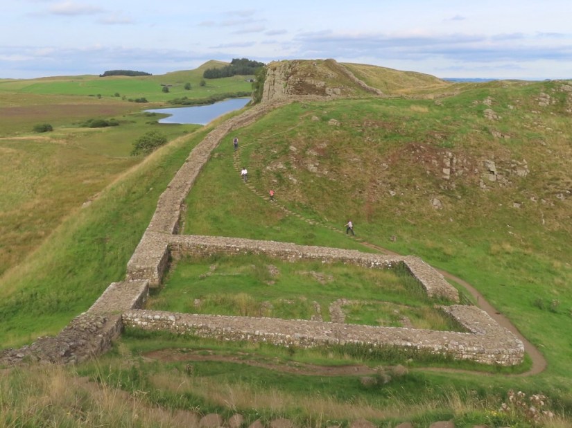
We had been too tired yesterday to take much notice, but the road had crossed Hadrian’s Wall to reach the farm. Today we stopped and took a closer look, walked a short way along the wall and took a selfie with the star of the trip!

Emperor Hadrian came to Britain in 122 CE and, in the words of his biographer, ‘was the first to build a wall, 80 miles long, to separate the Romans from the barbarians.’ At every mile of the wall, a castle guarded a gate, and two turrets stood between each castle. In today’s measurements, it is 73 miles, from Carlisle to Newcastle and quite a lot remains, being celebrated next year with the 1900 Festival.

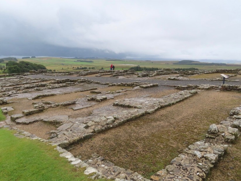
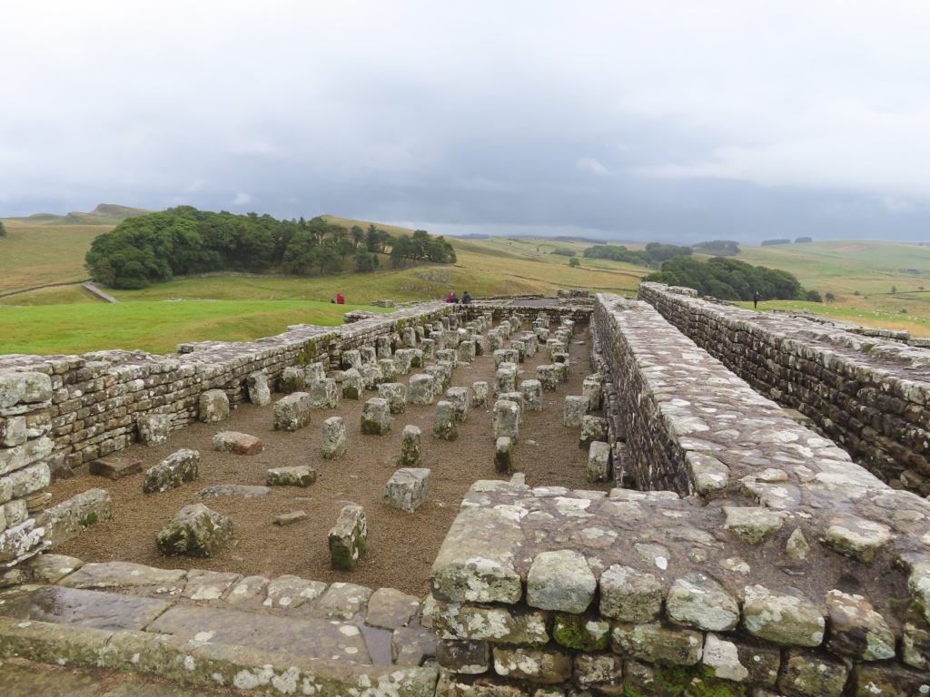
We drove to Housesteads Roman Fort, known as Vercovicium to the Romans and the best preserved of all 16 forts on the Wall. It’s location and the clarity of its excavations make it the most must see stop on the wall. The name Housesteads comes from the farm, built in the centre of the fort in 1604 and home of the Armstrongs, a notorious family of border reivers, well known horse thieves and cattle rustlers, but more about the reivers later.

In Roman times, the fort was occupied for around 280 years by up to 900 auxiliary soldiers and for much of that time there was also a vicus or civilian settlement just outside the walls. This helped meet the everyday needs of the soldiers, with houses, shops and inns and also fields to grow crops and raise livestock.

We walked from the car park up to the fort and looked round the museum, fortunately during another downpour, and noticed they they couldn’t resist a Game of Thrones reference, just as we couldn’t!

The ruins were extensive and easily recognisable as barracks …

… granaries …

… latrines …

… and also a bake house built into the outer wall.

I also noticed a novel in the shop called the Eagle of the Ninth Chronicles by Rosemary Sutcliffe which Chris remembered reading at school and I resolved to download it when I could.

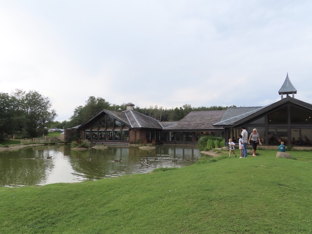
We were getting peckish and decided to grab a sandwich in the local pub, so we drove to Once Brewed, a village on Hadrian’s Wall, today consisting of an inn, a couple of farms and the The Sill National Discovery Centre and Youth Hostel. But it hasn’t always been thus …

Once upon a time there was a village northwest of Hexham called Twice Brewed with an inn, a couple farms and a stretch of road first laid down in 1751. The inn was, and still is, called the Twice Brewed Inn, and there are several stories about how it got its name, mostly about soldiers complaining about weak beer and demanding it be brewed again as it lacked fighting strength, or that this inn generally served stronger ale, hence twice brewed. Of course the inn is also situated between the brows or ‘brews’ of two hills … take your pick!

In 1934, the first Youth Hostel in England was built just beside the Twice Brewed Inn and it was opened by Lady Trevelyan, a staunch teetotaller. In her speech she mentioned the inn and said ‘Of course there will be no alcohol served on these premises so I hope the tea and coffee will only be brewed once.’ Henceforth the hostel became known as the Once Brewed Youth Hostel and when the Northumberland National Park Centre was built on the same site in the late 1960s, it was also christened ‘Once Brewed’.

Someone, at some point, either visited or heard about the village, and thought the name of the youth hostel meant ‘the youth hostel of the village Once Brewed’ and at that point Twice Brewed vanished from official maps. Now the description of the village on Google Maps or Wikipedia says ‘Once Brewed, also known as Twice Brewed or Once Brewed/Twice Brewed is a village in Northumberland, England’, but on the actual map it only says Once Brewed.

Nevertheless, one fact is definite: ‘Once Brewed’ is only called ‘Once Brewed’ because it’s next door to ‘Twice Brewed!’

Fortunately we located it with no trouble, took full advantage of the wifi and thoroughly enjoyed our lunch – my blt was delicious!

We drove back through the nearest village called Haltwhistle, but the rain was coming down again and they obviously have that quaint custom of half day closing on a Saturday so the place was deserted and we’ll come back another day.

Back at Hope Sike with a cuppa, I escaped to Roman Britain with my new book, an adventure starting in Silchester then north, over the wall in search of the lost standard of the ninth legion, stopping briefly to heat up some chilli. Fortunately, it is a trilogy as I managed to finish the first book before bed!

Map

Hope Sike

With a 326 mile drive ahead of us, we were on the road at 8am. We took the M40 north, the M62 toll round Birmingham, the M6 between Liverpool and Manchester and on to Carlisle before turning right for the final stretch.

We took turns driving, made a couple of stops for coffee and lunch and made fair time considering there were a couple of sections with slow traffic.

We we excited to see Tebay Services was on our route because there had been a recent tv show called the Lake District Farmshop all about the only family owned service station in the UK. It was opened in 1972 by John and Barbara Dunning after the M6 motorway was built through their farm and began as a small restaurant and shop selling locally sourced crafts and drivers’ essentials. Today they work with more than 70 producers from within a 30-mile radius, even selling local lamb and beef raised on their farm and butchered on site. It certainly didn’t look like any other service station I’ve been to and we bought pies, local cheese, a ginger cake, pasta sauce and some bread rolls.

Around 5pm we made our final approach from the main road onto a narrow side road, passed a couple of farms, over a cattle grid to an unfenced road with sheep everywhere and lastly to a rough track leading to Scotchcoultard Farm. Just four miles north of Hadrian’s Wall in the Northumberland National Park, we really are in the middle of nowhere, with just sheep for company.

We are staying in Hope Sike, part of a converted stone farm building made into a holiday apartment and named after the small stream which runs through the farm. We settled ourselves in and relaxed with a cuppa and a piece of the excellent ginger cake procured at Tebay.

Later we went for a wander to stretch our legs and acquaint ourselves with the local inhabitants … sheep, cows, pigs and a little dog who barked a lot and wanted us to throw a tennis ball for him … and also spotted the stream.

Chris came to terms with the combi microwave and persuaded it to heat our pies while I negotiated the two ring hob to cook veg, made interesting as all markings were missing from the dials!

Somewhere along the way, it became obvious that not only was the wifi a bit hit and miss, although we were prepared for that, but that neither of us had a phone signal either and we resigned ourselves to the refreshing concept that we really had got away from it all!

We had a play with the tv to check out which channels would be good for a weather forecast in the morning then I started writing my journal for the day offline, while Chris resorted to Digital Photographer and his comic … oops, Private Eye!

Map

Chris & Elaine Go North to The Wall 2021

We are continuing our 2021 exploration of Great Britain, and having already travelled east and west, now it is time to go north. But there is so much north when you live in Berkshire, so where to go? Having pored over a map, Chris said we should go and see Hadrian’s Wall and the decision was made.

We were lucky to find a holiday cottage close to the wall, with just one week left this summer and snapped it up. We will have a chance to explore the ruins and walk along the wall, probably in both directions! There are also plans to meet up with friends and to take advantage of the dark skies to go star gazing.

We wanted to take the return home a little more slowly, and found a few days self catering in both Kendal and Settle, so will be able to get a flavour of the Lake District and Yorkshire Dales on the way.

Exact plans will depend on the weather, so we are hoping for a repeat of sunny Southwold rather than stormy Skomer, but we will be prepared whatever the weather and are looking forward to another adventure together.

Journal Entries

Hope Sike

Housesteads Roman Fort

Milecastles and Turrets

Sycamore Gap

Haltwhistle

Vindolanda

Ashgill Force

Kirkstone Pass

Blackwell

Blelham Tarn

Keld Waterfalls

Malham Cove

Malham Tarn

Ingleton Waterfalls & Twistleton Scar

Map

Stormy Southwold

We were all packed up and left the Wagon Store by 9.00. It was a great base for our stay in Southwold and we left a thank-you message for Sue and Eric. It wasn’t until we drove down to the harbour to get a crab from Samantha K to take home that we realised how stormy the sea was. We were surprised to still see hardy bathers …

Anyway, Chris was in his element taking photos, and talking to strangers (hello Clare!) but eventually we had to get on the road.

We did make one stop, for a coffee at the Maltings in Snape as being so close, we felt we ought to look round. Once used to malt barley for the brewing of beer, the Maltings became redundant in the 1960’s and Benjamin Britten and Peter Pears converted the largest malthouse into a concert hall. This gave a permanent home to the famous Aldeburgh Festival of classical music which is held each June and later additional buildings were converted into a centre to educate and support young musicians. Today there is a collection of shops, galleries and restaurants which we wandered round. We saw an underwhelming exhibit by Maggi Hamling, and some rather swanky shops selling goods that wouldn’t have been out of place in Liberty’s or Fortnums and had coffee and some delicious cake.

Well this is the end … just the drive home now so fingers crossed that the A12 and M25 will be kind to us … until next time!

Map

Seaside Supper in Southwold

We awoke to the first really overcast day since we arrived, a shame as I really wanted to take a good photo of the town from the pier and it would have looked so much better with blue sky … maybe tomorrow!

While there, we noticed the two small shops on the pier were open for the first time and a souvenir was successfully chosen … a fish to decorate the kitchen and remind us of our holiday.

Walking seemed a perfect choice for the day so we went to Old Hall Farm which advertise a cafe and walk. They also advertise a maize maze, but unfortunately that doesn’t open until tomorrow! We started with lunch and munched through crab salad and a lentil burger … and more chips … after all we are on holiday … and we did then work some of it off with a 4 mile walk. The path took us through a meadow down to a area of reedbeds, fens, dykes and pools created in 1999 to provide new breeding habitat for bittern and other wildlife.

Most of the birds which nest in the reeds have already fledged this year, but we watched activity round a pond from a hide … until they got spooked and all flew away!

At times, all we could hear was the rustling sound of the breeze blowing through the reeds but later the distant sounds of Latitude carried on the wind, and we were quite pleased to be here alone rather than sharing a field with 40,000 others 5 miles away in Henham Park.

The path continued along the line of mudflats where we spotted several feeding waders – egrets, oyster catchers and curlew as well as shelduck and lots of black headed gulls …

… before returning through fields to Old Hall.

Well here we are, our last evening in Southwold … what to do … how to go out with a bang? What had been a pretty overcast day turned into a sunny evening so we packed up supper and took it to the beach. We returned to the same stretch of beach we had enjoyed on our first day here and went prepared for it to be a little chilly.

Surprisingly, once we found a sheltered spot and rigged up the windbreak, it wasn’t chilly at all and we feasted on gourmet cheese from Slate …

Firstly Baron Bigod, “an exquisite soft brie-style cheese made in Suffolk at Fen Farm Dairy near Bungay where Jonny and Dulcie Crickmore use the raw rich milk from their Montbéliarde cows to handmake this gold medal winning cheese to a traditional French recipe. The taste is delicate at its centre with yoghurt acidity. Towards its white bloomy rind, which develops over eight weeks of salting and aging, the flavour becomes creamier and richer with aromas of earth and mushroom.”

And then Suffolk Blue “a luxuriously creamy lightly blue-veined cheese handmade at Whitegate Farm in Creeting St Mary, Suffolk where husband and wife team Katharine and Jason Salisbury, have installed a robotic milking system for their herd of Guernsey and Jersey cows. The rich pasteurised milk from these cows gives their cheeses a delightful buttery flavour. Katharine adds Penicillium Roqueforti spores to her Suffolk Blue curds then pierces the cheeses after a week to encourage veining.”

Cheese was served with slices of ripe rocha pears and Nairn rough oatcakes and paired with Adnams Ghost Ship, “a spooky citrus pale ale which takes its inspiration from Adnams 600-year-old haunted pub, The Bell in Walberswick where we had coffee on our first day here. It is brewed with Pale Ale, Rye Crystal and Cara malts and has Citra and a blend of other American hop varieties to create some great citrus flavours.” Made into shandy, this complemented our last supper perfectly … yum!

It was a wonderful end to a fabulous week in Southwold … such a shame that Desni had other plans!

Map

Marshes in Southwold

This morning we took a footpath which follows Buss Creek, a water channel that leads to the River Blythe. The name is thought to have come from seagoing Dutch and Flemish sailing craft called busses that used to be used for herring fishing. The path was raised above the creek on a dyke and we had a good view across the fields to the old wind pump tower.

We saw a man taking a mower for a walk …

… and more men repairing the Bailey bridge which carries the footpath to Walberswick …

… and saw an egret in the shallows.

On to the Harbour pub, an Adnams house, as are all the pubs in Southwold, and Chris stepped up to the crease and had a pint of Breakpoint, a farmhouse pale ale, in which land and sea collide!

Southwold’s brewing history began with the ale wives of the 14th century, constantly in trouble with the law for various infringements when beer was the everyday drink since water was often polluted. By the 17th century, most prominent names of Southwold had a hand in brewing. In 1825 the brew-house at the back of the Old Swan inn was sold and re-built as the Sole Bay Brewery which later changed hands several times before being bought by the Adnams brothers from Berkshire in 1872. George Adnams got bored with country life, left for Africa and was eaten by a crocodile, but his brother Ernest stayed and converted Adnams into a limited company. Verging on insolvency by 1902, it was rescued by P C Loftus, an experienced brewer, who acquired a stake, reorganised the company and turned things around. Its survival was again at risk in the 1960’s as consolidation of the brewing industry and development of keg beer threatened. Fortunately a new generation on the family and the revival of real ale by CAMRA helped secure their future. Today Adnams has a huge presence in Southwold with the brewery, umpteen pubs with dining, and a shop not just selling their own huge range of beer, but also other diversification including their various distilled spirits and collaborations which bring Adnams branded worldwide wines as well.

From there, it was across the town marshes which have been managed for centuries as grazing marshes, using an elaborate system of dykes which drain out to the River Blythe at low tide. Water levels are raised during the winter, ready for the breeding season in the spring, lowered in the summer so fields can be harvested for hay and when cattle return to farms in the autumn, grass is left at an ideal height for wintering birds.

Then across the common and golf course, and through the back paths.

As we returned to Reydon, I took a snap of the village sign. We’ve enjoyed looking out for these signs, usually in a prominent place, but not always easy to photograph, so here is a small collection we passed on foot! The meanings of some are obvious like the Battle of Sole Bay for Southwold and the House in the Clouds and Windmill for Thorpeness. Others are a little more complicated! Reydon comes from Rye on the Hill, hence the sheafs, also for agriculture, the oaks which grow well here. The central cross and cogwheel depict the importance of the church and blacksmith in village life and the brick wall is for strength and solidarity. Kessingland, which being on the east coast is one of the first places the sun touches at dawn also has the three crowns of East Anglia. The shield with a ship’s wheel and bell can all be found in the local church and the rest relate to agriculture and the sea

In the afternoon, we drove down to the Pier and took advantage of a sunny afternoon for a little more beach time as it might be cloudy tomorrow. It was a little blowy, but we found a sheltered corner, and I even went in for a dip.

Later we went along the pier to find out more about the Under The Pier show, a quirky amusement arcade with a difference. There are no slot machines or noisy electronics, instead a bunch of interactive machines made by Tim Hunkin – you can walk a dog, have your head examined, go on a package holiday or take a trip under the pier. We thought we’d have a go, but it was all a bit busy so we gave it a miss.

He also made the Quantum Tunneling Telescope at the end of the pier which in theory allows the viewer to see something a little more exciting than just the horizon, except unfortunately it wasn’t working quite as it should when we had a go.

We had dinner at The Sail Loft, and felt pleased we’d thought to book ahead when we saw crowds being turned away. We had a lovely dinner featuring hummus, half a pint of prawns, Goan pork curry and a beetroot and falafel burger … with chips of course! The sun was low in the sky as we left … perfect for a few pics on the way back.

Map

Whimsy in Thorpeness

The small village of Thorpeness was next, and we had read a little about it being a fantasy holiday village, and it sounded a little like Portmeiron. It was the dream of Stuart Ogilvie who bought the hamlet in 1910 and built holiday homes in mock Jacobean and Tudor styles, a country club with golf course and swimming pool and invited his friends and colleagues to spend their holidays here. The village is dominated by the Meare, a shallow boating lake which was designed with landings and inlets for children to explore, named after places in Peter Pan as J.M. Barrie who was a family friend. It is still popular today, but rowing looked too much like hard work, so we didn’t explore and find the Pirates’s Lair, Wendy’s House or the crocodile!

We had a wander and saw the Almshouses …

… and saw Ermintrude, who at 92 is the oldest bus in Britain in regular work, and runs between Aldeburgh and Thorpeness in the summer …

… and a variety of houses.

Nothing was allowed to spoil the fantasy, so Ogilvie replaced the ugly metal pump which drew water from the well with a relocated windmill ….

… and found a whimsical way to conceal the water tower, transforming it into The House in the Clouds, now available as an unusual holiday let as the village got mains water in 1963.

We walked back along the beach, yet another shingle beach, although this was beautiful golden sand when Ogilvie started his village in 1910. I guess this might be the case with many of the beaches along this stretch of coast as sand seems a little sparse these days, with Southwold beaches being the sandiest.

Thorpeness remained mostly in family ownership until 1972 when Ogilvie’s grandson died and much of the village was sold off to pay death duties.

I had been reading about Dunwich and realised that we hadn’t actually visited the village and beach the other day, so we stopped on the way back. Dunwich was once a thriving medieval port and capital of the kingdom of East Anglia and is another casualty of the coastal erosion and storms in Suffolk which have washed most of it away. We walked along the cliff path, keeping well away from the edge and saw the last remaining grave from the church …

… and the ruins of Greyfriars, once a monastery with a similar tale to Leiston, dissolution and conversion to a country house, but this was later demolished and it’s been left as a ruin.

There was far less breeze today so we stopped at the beach for a bit. I even thought I would swim, but I got in so far, spotted a couple of jellyfish and beat a hasty retreat, and resigned myself to playing in the sand and sitting in the sun!

With the sun still shining, it was Mojito time and Chris remains Uno champ then more deli treats and a little bulgar wheat salad made with our first runner beans of the year spotted in the greengrocer in town.

Map

Hollyhocks in Aldeburgh

Today we went to Aldeburgh to explore, just 17 miles down the coast. We parked at the end of the town beside the sculpture Scallop which is dedicated to the composer Benjamin Britten who lived here and walked along the beach in the afternoons. It was created from stainless steel by Maggi Hambling with words from Britten’s cheery nautical opera Peter Grimes pierced through it. It has caused controversy since it’s unveiling in 2003, has been vandalised many times and had petitions for both its removal and retention. We couldn’t see what the fuss was about, and thought it interesting to walk round and catch from difference angles.

We walked into the town, past fishing boats pulled up on the shingle and fishing sheds selling fish of all sorts and smoked fish too.

In the centre is the Tudor Moot Hall, which was the town hall for centuries and now houses the museum.

We had coffee at the Two Magpies Bakery in the High Street, then continued through the town back to the sea wall.

We could see the Martello tower in distance, apparently a unique quatrefoil tower and the largest of the 103 towers built to resist a threatened Napoleonic invasion. It is the only surviving building of the fishing village of Slaughden, which was washed away by the sea by 1936.

We walked back along the front, admiring the colourful houses, many available as holiday lets …

… and I have never seen such an amazing collection of hollyhocks in bloom, brightening up every garden.

Halfway up, a sign encouraged us to add a stone to The Angel of the East …

… so I did, with purple writing at the bottom of the photo!

Walking back past the fish sheds, I stopped at the Aldeburgh Smokehouse and picked up an Aldeburgh Noon Tart for lunch – a crispy tart filled with creamy smoked haddock and smoked cheddar.

Chris had a Moroccan empanada in his pocket from the Two Magpies so we sat on a bench overlooking the Scallop, happily munching.

Map

Heather in Dunwich

This morning we began with a foraging trip, firstly to Samantha K’s at the harbour for fish. They have two boats, Laura K and Emma H and one goes out for crabs, lobster and shellfish, and the other for white fish which they sell in their shop daily, as well as smoked fish from Lowestoft’s oldest smoke house. I purchased a dressed crab, one of my absolute favourites and also a smoked mackerel.

We then headed back into town and were lucky to find a parking space. We did a little deli hopping and picked up a mixture of pies and some local cheese in Slate, a little quiche and a pot of mixed salads in the Black Olive and some beer and wine in Adnams. We returned to put it all in the fridge, had coffee then set out to the National Trust site at Dunwich where various walking routes lead through the heathland bordering the coast. As we arrived, we realised there was an added bonus as there were swathes of bright purple bell heather in bloom.

In fact, this whole area is covered in common heather and must be stunning in August when it flowers. We could see Southwold to the north and Sizewell to the south.

We had a walk in the heather …

… then wandered down to the beach but decided not to sit as it was quite blowy without a windbreak. We had an ice cream and decided to drive closer to Sizewell, to try and take a better picture, and we but wondered if it was a bit like morbid curiosity to be wanting to photograph a nuclear power station, however architectural it was!

The B road wasn’t particularly wide, with some nasty turns and we started seeing protest signs. We had already seen a sign in a house window in Southwold about the proposed building of Sizewell C.

EDF say it will generate enough electricity for 7% of the UK’s needs, creating over 5,000 local jobs during the 9 year construction. Local opposition groups claim the project will damage important wildlife habitats, not to mention the disruption during construction and the cost of £20bn, but the final decision is yet to be made.

We were able to get far closer than we would have expected, and parked beside Sizewell beach and took a walk. The juxtaposition of the nuclear power station, and people walking and swimming just seemed incongruous.

Yet more ruins on the way home as we passed Leiston Abbey, but in this case it was Henry VIII’s dissolution of the monasteries to blame rather than coastal erosion! Since then it has been used as a farm, converted to a Georgian house, been a religious retreat and now is home to a trust who train chamber musicians.

Later we made up a couple of small plates with some leftovers, potato salad and the deli goodies and sat in the garden.

Map

Ruins in Covehithe

We headed north up the A22 to explore, stopping first at Kessingland from which we could see as far as Lowestoft, the most easterly settlement in England. Marram grass was planted behind the beach in the 1900s by Henry Rider Haggard who had a holiday home here and it has reduced erosion.

A stop for a walk and coffee and we drove back to Covehithe and parked behind others at the side of a lane. Covehithe was a thriving community with a wealth to rival Lowestoft in the 14th century when St Andrews church was built. Later the river silted up, the population dwindled and the church fell into disrepair and was pulled down except for the tower, and the stone used to build a smaller church within the ruins which has been in use since 1672.

Then we made our way about a mile down the footpath to the beach, past a field of pigs, having a lovely time in a muddy puddle.

Needless to say, with more effort required to reach it and no facilities, there were few visitors. We could see Southwold about 3 miles away, although the beach between the two is only passable at low tide due to bad erosion and even the Suffolk coastal path takes a more inland route here.

We sat for a while and ate our sandwiches, then chilled, listening to the waves breaking.

We returned to Southwold in time to shower and walk to Coasters for dinner, having booked a table for 6pm. We had a fabulous meal of crayfish and local pork for me and blue cheese and walnut pate then veggie gnocchi for Chris, all washed down with a very nice dry French white.

Map