 The Urabamba river kept us company as we drove into the upper part of the Sacred Valley. The countryside changed completely, with far more arable land, and trees. In fact there are many eucalyptus, introduced from Australia to use for the railway and now invaluable as they grow in just 3-4 years and can be used for building and to fuel fires. They do take a lot of water from the soil, and moves are being made to try to return to planting indigenous species.


We stopped at Raqchi, an Inca control point on the road to Cusco.
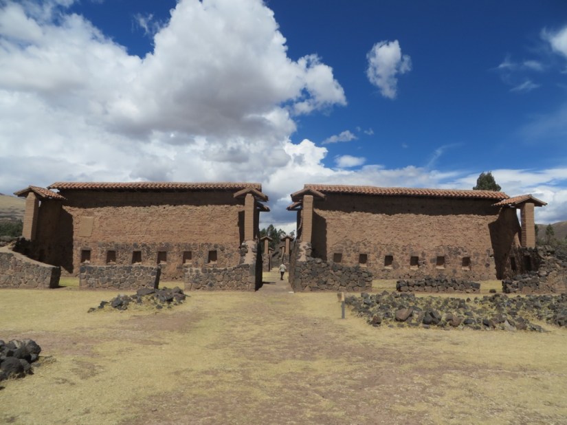
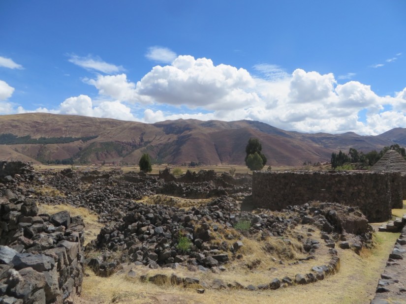
The buildings, consisting of living areas for priests and administrators, a guesthouse for travellers, and some 150 round storehouses to contain food collected in taxes from the people, as well as the most prominent building, the Temple of Viracocha, in honour of the Inca’s god of gods. This structure had a central adobe wall, flanked on each side by a row of 11 columns, over which a pitched roof would have stretched, some 25m beyond the columns each side, and was probably the largest single roof in the Incan empire. Today a surprising amount of the main wall survives and other parts have been reconstructed, and the sun still rises at the equinox in line with the buildings.

Cusco was the centre of Tahuantinsuyu, the formal name for the Inca empire, meaning the four quarters of the world, and the great royal roads to the four suyus or quarters began in the main square. There were also four gateways leading out of the city to the suyus and as we approach Cusco we passed one.

There was a network of over 14,000 miles of paved roads stretching from Ecuador to Chile and without the horse or the wheel, transportation was by porter or using llamas as pack animals. Communications were by teams of couriers who ran relays between way stations.
We will be returning to Cusco later, but for now we are travelling through, and staying in a village called Huaron with Kelly at the Green House, a fabulous ecofriendly B&B, where we had a lovely homemade dinner after such a long day.


The next day we set off and using a mixture of local buses and a taxi, visited Moray set on a high plateau above the Urabamba river where there are several enormous terraced circular depressions built by the Incas.


The purpose is uncertain, but their positioning creates a temperature difference of around 15°C between the top and the bottom and this may have been used by the Inca to study the effects of climate on crops – an Inca agricultural experiment station – and evidence of pollen from imported plants supports this theory.
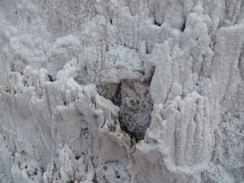
We then visited the Salineras of Maras. We started at the top, and walked down through the salt pans on narrow paths. Since pre-Inca times, salt has been obtained in Maras by evaporating salty water from a local subterranean stream. The flow from the spring is directed into an intricate system of tiny channels enabling the water to run gradually down onto the several hundred ancient terraced ponds.


The water evaporates, the salt precipitates then the salt is carefully scraped up. The salt mines are available to anyone wishing to harvest salt and prospective farmers just have to consult the cooperative, learn how to work the pond and begin. Many just work here in the dry season and farm the land in the rainy season when the salt pans cannot be used.

We continued walking down to the river, which we crossed on a rickety bridge. Along the way, we saw adobe bricks being made, then caught the bus back.


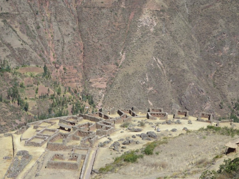
On Sunday we went to Pisac to see the ruins and the market. We went with Stephanie, Mariya, Clinton and Liz who are also staying at The Green House, and managed to squeeze onto the little local bus! Once in Pisac we took a taxi up the hill to the ruins, leaving the other to shop.
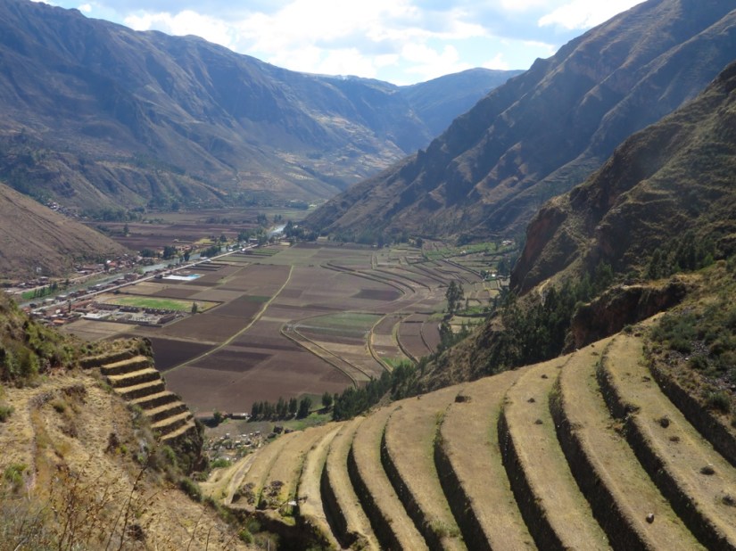
The first splendid view of the site is of the steep hill covered in narrow agricultural terraces, catching the sun in their contours. They are thought to represent the wing of a partridge (pisaca), from which the village and ruins get their name and corn, potatoes and quinoa would have been grown here.

Next we climbed Qantusraqay, a residential area of rough stone buildings, walls with niches and small squares which was probably a military garrison to guard against incursion from the Anti people from the rainforest. To the right, embedded in the hillside, is a huge Inca cemetery with some 3,500 tombs, although the mummies are long gone.


The path crosses a military wall with a perfect trapezoidal door, known as the Door of the Serpent and continues through an enlarged rock fissure where the Incas just bored through the rock, giving the Kallaqasa or Split Rock tunnel.
We saw these gateways but don’t know what the holes are for …

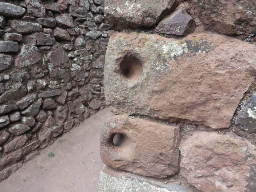
… and people who couldn’t read …!


We then saw the Intiwatana, or sun calendar in Qechua, a volcanic outcrop carved into a “hitching post for the Sun” or Inti. The angles of its base suggest that it served to define the changes of the season.

We began the descent, passing another residential area, arranged in a semicircle and probably homes for the elite.
We continued down the narrow path, which descended, crossing a stream and some terracing, down to the back of Pisac market.


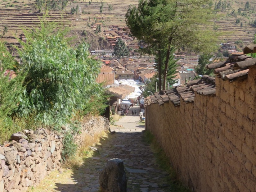
We wandered round, past trinkets and weaving and purchasing a small llama, then to the business end of the market with women wearing bowler hats, selling their wares.


Both Quechua and Aymara women in Peru and Bolivia took up the style of wearing bowler hats since the 1920s. According to legend, a shipment of bowler hats was sent from Europe to Bolivia via Peru for use by Europeans working on railroad construction. When the hats were found to be too small, they were given to the local people.
Over another delicious dinner, we all shared our day and our travels. Tomorrow we move on, remaining in the Sacred Valley, but further west in Ollantayambo.
